4/11-4/13/2025
With the Star Legend docked in Istanbul, we disembark
in the morning for a three-night stay in the city. With a population of over 15
million, Istanbul is Turkey’s largest city and the economic, cultural, and
historic heart of the country.
 |
| Entering the Dardenelles Strait |
The city straddles the Bosporus Strait, which is
the only passage from the Black Sea to the Mediterranean. The strait also
splits the city geographically into a “European side” and an “Asian side,” as
the city spans two continents.
 |
| Egyptian Obelisk in Hippodrome |
Approximately two-thirds of the city’s
population reside on the “European side.”
We begin our tour of Istanbul with a bus ride that brings us
to the Hippodrome of Constantinople. Built by the Roman Emperor Septimius
Severus in AD 203, the Hippodrome was greatly renovated by Emperor Constantine
the Great in AD 324. As the sporting and social center of the city, it was used
for horse and chariot racing and imperial ceremonies.
 |
| German Fountain |
Today it is a large
square named Sultanahmet Square. As we walk through the square, our guide
outlines its history and points out some of the famous statues of gods,
emperors, and heroes that adorn the square.
 |
| Blue Mosque Exterior |
Our guide tells us that to raise
the image of the city, Constantine and his successors brought works of art from
all over the empire to adorn it. We view the Serpent Column, which was brought
from the Temple of Apollo at Delphi, and the Obelisk of Theodosius, which was
brought from Egypt. We also visit more recent additions to the square, such as
the German Fountain, which was built by the German government in 1900 to
commemorate the visit of German Emperor Kaiser Wilhelm II to Istanbul.
We leave the Hippodrome and follow our guide to the nearby
Blue Mosque, officially the Sultan Ahmed Mosque.
 |
| Blue Mosque Interior |
Started in 1609 and completed
in 1617, the mosque with its six iconic minarets is a showcase of classic
Ottoman architecture.
 |
| Another Blue Mosque View |
After waiting in line and removing our shoes, we enter
the mosque and are awed by the central dome and four cascading semi-domes that
dominate the interior. The central dome is 77 feet in diameter and 141 feet in
height. Over 21,000 Iznik tiles, featuring intricate floral patterns, line the
ceiling and walls. We view the huge prayer hall (210 x 236 feet), which is
covered with an elaborately woven carpet. The mosque has 260 windows that admit
natural light, which were originally decorated with intricate stained-glass
designs. Most of these windows have been replaced with modern, less elaborate
windows, which likely makes the mosque’s interior more illuminated. We view the
second-level galleries as our guide relates some of the history associated with
the works we see. Still a working mosque, it is closed to visitors during
prayer time.
We exit the Blue Mosque and board a bus that takes us to a
local restaurant for lunch.
 |
| The Hagia Sophia Mosque |
Afterwards we are driven to the Hagia Sophia,
officially the Hagia Sophia Grand Mosque, which stands opposite the Blue
Mosque.
 |
| Hagia Sophia Interior |
Originally built as a Christian church in the 6th century AD, it was
converted into a mosque after the Ottoman conquest of Constantinople. It was
later converted into a museum and then reconverted into a mosque in 2020. With
its full pendentive dome allowing for an enormous interior space, it is considered
to be the epitome of Byzantine architecture and became the quintessential model
for Eastern Orthodox church architecture. As a working mosque, we remove our
shoes, and the women don headscarves to enter its massive interior, which is
further heightened by the 182-foot dome.
 |
| Christian Mosaics |
In the upper galleries, our guide
describes the depictions in the Christian mosaics and the giant medallions
bearing Islamic calligraphy.
Leaving the mosque, we descend underground and into the
Basilica Cistern, the largest of several hundred ancient cisterns that lie
beneath Istanbul.
 |
| Basilica Cistern |
Only a short distance from the Hagia Sophia, the cistern was
built in the sixth century during the reign of Byzantine Emperor Justinian I.
The massive underground chamber is 453’ x 213’ (105,000 ft.² in area) with a
ceiling supported by 336 marble columns 30 feet high, making it capable of
holding 2,800,000 ft.³ of water. Today, the cistern holds little water and
serves as a tourist attraction. We leave the cistern and ride to our hotel, where we check
in and enjoy a buffet dinner. It was a very busy and tiring day.
This morning, we meet David and Linda for breakfast and then
board a bus for guided sightseeing at the 15th-century Topkapi Palace.
Construction of the palace began in 1459, shortly after the conquest of
Constantinople.
 |
| Imperial Gate of Topkapi Palace |
For nearly 4 centuries it served as the administrative center
of the Ottoman Empire and was the residence of the sultans. The huge palace
complex (~160 acres) is laid out over four main courtyards and many smaller
buildings comprising hundreds of rooms and chambers.
 |
| View of Palace Grounds |
However, only the most important
rooms are open to the public—the Imperial Harem, the Treasury, the Council
Hall, and the Sacred Relics Room. After the end of the Ottoman Empire in 1923,
the Turkish government transformed the palace into a museum that is
administered by Turkey’s Ministry of Culture and Tourism. We follow our guide through the Imperial Gate and into the
first courtyard—the largest of the four courtyards.
 |
| Gate of Salutation |
We are struck by the
parklike appearance of this courtyard and learn that many of the historical
buildings no longer exist. This courtyard was also known as the Parade Court,
where court officials dressed in their best uniforms would line the path that
led to the Gate of Salutation and into the second courtyard.
Passing through the Gate of Salutation, or Middle Gate, we
enter the second courtyard of the palace.
 |
| Imperial Council Dome |
This busy courtyard contains the
Imperial Council, the Imperial Treasury, and the palace’s hospital, bakery,
kitchens, and stables. We begin our exploration of this courtyard by passing
through the gilded doors of the Imperial Council.
 |
| Ornate Rifles in the Imperial Treasury |
The domed chamber of this
building housed the cabinet of the Ottoman Empire for most of its history. The
walls and ceiling are lavishly painted and decorated with gold, and both the
exterior and interior are ornately decorated in the rococo style.
We move on to the Imperial Treasury, which was used to
finance the administration of the state.
 |
| Another Arms Display |
Today, the Imperial Treasury has been
converted to a museum with exhibits of arms and armor from the period. The arms
collection consists primarily of weapons that remained in the palace at the
time of its conversion.
 |
| Kitchen Cookware |
Spanning 1300 years from the seventh to the 20th
centuries, it is one of the richest collections of Islamic arms in the world.
The collection contains objects manufactured by the Ottomans themselves,
gathered from foreign conquests, or given as presents. As we view the exhibits,
we are amazed at the detail and workmanship that went into the production of
the arms and armor.
After leaving the Imperial Treasury, we make our way to the
palace kitchens, which consist of 10 domed buildings and 40 chimneys. They were
the largest kitchens in the Ottoman Empire, with a staff of over 800 people
preparing food for about 4000 people daily.
 |
| The Throne Room |
As we progress through the
kitchens, we view exhibits of kitchen utensils and massive cookware. There is
also a collection of silver gifts, as well as a large collection of
porcelain—much of it Chinese porcelain from the mid-15th century onward.
 |
| A Room in the Harem |
This collection
of nearly 11,000 pieces of Chinese porcelain is among the finest porcelain
collections in the world.
We enter the third courtyard through the Gate of Felicity,
which separates the “inner court” from the “outer court.” The gate is ornately
decorated in the rococo style with rich paintings and gold. The third courtyard
is the heart of the palace and primarily comprises private and residential
areas. No one could pass through this gate without the authorization of the
Sultan. Right behind the Gate of Felicity is the Audience Chamber, also known
as the Chamber of Petitions. The audience chamber contains the main throne
room, richly decorated with intricate tiles, carpets, mosaic works, precious
jewels, and gold.
 |
| Spoonmaker's Diamond |
Also, in this courtyard is an extension of the Imperial
Treasury (an “inner” treasury as opposed to the “outer” treasury in the second
courtyard) that houses a vast collection of artworks, jewelry, heirlooms, and
money belonging to the Ottoman dynasty. Many of the items on display were gifts
made to the Sultan. Chief among these is the Spoonmaker’s Diamond, an 86-carat
pear-shaped diamond considered to be the fourth largest diamond in the world
and the most expensive exhibit in the palace.
 |
| Topkapi Dagger |
Another famous exhibit is the
Topkapi Dagger, a gold and emerald-studded dagger with a scabbard covered in
diamonds and enamel.
Lastly, in the third courtyard, we are shown the Imperial
Harem, a residential section of the palace with over 400 rooms that housed the
sultan’s wives and concubines, his family and children, and their servants. We
pass to the main entrance of the harem and view many of the courtyards,
passages, baths, privy chambers, and apartments used by its residents. We learn
that the harem was expanded and redecorated by several sultans over time and
evolved into the huge complex it represents today.
We conclude our palace tour in its fourth courtyard. Our
guide tells us that this was the innermost private sanctuary of the sultan and
his family. Originally part of the third courtyard, it has recently been
identified separately to better identify it.
 |
| The Grand Bazaar |
It consists of a number of
pavilions, kiosks, gardens, and terraces.
We leave the palace and ride to a local restaurant for a
traditional Turkish lunch. Afterwards, we walk over to the Grand Bazaar, one of
the largest and oldest covered markets in the world. Founded in the 15th
century after the Ottoman conquest of Constantinople, the marketplace today
contains over 4000 shops spanning 61 covered streets. It employs over 26,000
people and attracts between 250,000 and 400,000 visitors a day.
 |
| Golden Wares in the Bazaar |
We are given
two hours of free time to explore and shop the bazaar, and we begin on a street
that is approximately one-fourth of a mile long. All the shops are equally
spaced on each side of the street, and each features a specific commodity for
sale—handmade carpets, gold and other kinds of jewelry, ceramics, candies and
sweets, spices, textiles, and antiques. We don’t go very far before the
offerings in the shops start repeating themselves. We come upon a leather goods
store that is featuring high-quality lambskin leather jackets, which interest
David and Capt. Larry.
 |
| Our Boat for the Strait |
The shop owner quotes a price of around $200 USD for the
jacket, but we know that bargaining is expected. After a few minutes of
wheeling and dealing, David gets the price down to $150. Capt. Larry then
announces that they will each take a jacket for $100 each. The dealing then
gets really lively until we finally settle on a price of $120 each. We pay the
owner and leave knowing that the jackets would probably sell for in the
neighborhood of $400 in stores in the US or Canada. We are pleased.
On our last day in Istanbul and on the tour, we begin our
day with breakfast with David and Linda (sound familiar?).
 |
| A Waterfront Yali |
We begin an intercontinental journey
by boarding a motorcoach and crossing the Bosporus Strait to Istanbul’s Asian
side and embarking on a private boat for a sightseeing cruise along the strait.
The Bosporus Strait is a natural strait that connects the Black Sea with the
Sea of Marmara. Only 19 miles long, it is the world’s narrowest and one of the
busiest straits and forms one of the continental boundaries between Europe and
Asia.
 |
| Inside the Rusem Pasha |
As we begin our cruise, our guide informs us about the waterfront houses,
or mansions (yali), built along the Asian and European shorelines during the
Ottoman period. These elegant mansions are quite impressive, and we learned
that many have now been turned into restaurants and museums.
We disembark our boat and ride to one of Istanbul’s most
revered mosques—the Rusem Pasha Mosque. Completed around 1563, this mosque was
commissioned by Rusem Pasha, the Grand Vizier of the Ottoman Empire under
Sultan Suleiman the Magnificent.
 |
| Another Interior View |
This mosque is noted for the many different
designs of Iznik tiles that cover nearly every vertical surface. The floral,
geometric, and arabesque tile patterns in cobalt blues, emerald greens, and
deep reds are quite striking. While we are viewing the mosque, our guide
introduces us to the Five Pillars of Islam, fundamental acts of worship that
define a Muslim’s faith and practice.
 |
| Intricate Tiling |
The pillars are faith, prayer, charity,
fasting, and pilgrimage, which guide Muslims toward a life of faith, humility,
and service.
Leaving the mosque, we walk a short distance to the Misir
Carsisi, Istanbul’s Spice Bazaar and the center for the city’s spice trade.
With 85 shops selling spices, Turkish delight and other sweets, jewelry,
souvenirs, and dried fruits and nuts, it is Istanbul’s most famous covered
shopping complex after the Grand Bazaar.
 |
| A Spice Bazaar Shop |
Walking through the bazaar gives us an
intoxicating sensory experience with shops bursting with color, aroma, and
flavor.
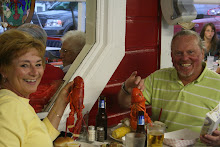
We eat like a local at a restaurant near the Spice Bazaar
and return to our hotel. We spend the afternoon packing our bags for our
departure tomorrow and get ready for tonight’s farewell dinner and reception in the Istanbul Orient Express train station that has been converted to an entertainment venue.
 |
| Dinner in the Train Station |
We say goodbye to our fellow “Tauckies,” to David and Linda, the next morning
at breakfast. We are already beginning to mull over some options for our next
adventure together. Until then…


.JPG)