Saturday, July 16, 2011

Oh! Oh! Oh! Ohio

Ashtabula light
Sunset at Geneva State Park
We left Erie, PA after spending the Fourth of July there. We had hoped to see some fireworks, but we were told that with the budget cutbacks Erie could only afford one fireworks display and this was reserved for the Erie Days festival held in August. So the next morning we eased out of the harbor and headed for Geneva State Park. We had really good weather for this run and the lake was calm. So calm, in fact, that we toyed with the idea of pushing on to Cleveland. However, after we had done the 50 miles to Geneva State Park, we decided to pull in and spend the night. This is a nice marina, but the transients were placed on a wall at the far end of the marina and we literally had an approximate one-half mile walk to the showers and restrooms. To make the transients feel better, we guess, there was a portable toilet next to us, but Jane said it was one that only men would use! Since the marina was less accommodating than others we had used, we didn't spend any money here and turned in early for a long run to Vermilion, OH the next morning.

Sunrise at Geneva State Park
Cleveland at a distance
At McGarvey's Landing
Lots of boats & condos
Vermilion Yacht Club
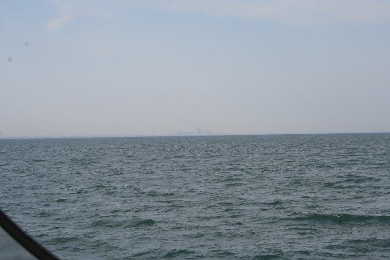
We left Geneva State Park around 0600 the next morning for a 70+ mile run to Vermilion. Overnight the wind kicked up some and the lake was rougher than the previous two legs. We decided to bypass Cleveland, since we would only get to spend one night there, and try and come back and visit by car. Our goal was to get to Marblehead, OH on Thursday, July 7, so we could rest up and organize the boat for the party that was being planned for us by family members on July 9. We hit Cleveland around noon and rolled into Vermilion around 1500. Vermilion really impressed us. There are several lagoons that have been dredged along with a river and boats are everywhere. The river is wall-to-wall boats for over a mile from its mouth and there are several yacht clubs and marinas along the way. The guide said that reservations are recommended for weekends and it is not hard to imagine why. In fact, this is one place that we probably wouldn't want to visit on a weekend due to the congestion. We tied up to a wall at McGarvey's Landing and paid our $1.50/foot dock fee to the Vermilion Port Authority. Jane took off to do some shopping while Capt. Larry did some boat chores. We decided to go to the Quaker Steak & Lube restaurant for some beers and appetizers and then finish some leftovers we had on the boat. It was bike night at the restaurant and we viewed the motorcycles and some TV while we ate some not-so-interesting food.

Cedar Point amusement park
Marblehead lighthouse
The next day we had some time to kill. We called our Marblehead Lakeside hosts, Pam & Kevin Vogel, who said that they would be available around mid-afternoon to guide us into our dockage that they had arranged for us. Since it was only a 20 mile run from Vermilion to Marblehead, we went shopping for souvenirs in the morning. We visited with some other boaters and had lunch, then decided to head out for a slow ride to Marblehead, arriving around 1500. We no sooner cleared the Vermilion breakwater when we got a call from Kevin & Pam that they we on their boat and getting ready to meet us. We didn't want them to have to wait a long time for our arrival, so we put the boat up on plane and scooted over to Marblehead. This actually worked out better as going faster reduced the choppiness of the waves that were on our starboard beam. We got to our slip and secured the boat then had some cold ones with Kevin & Pam. It was really great to seem them again.
Kevin & Pam on Slow Ride

Monday, July 4, 2011

We Start Our Great Lakes Leg

Turn right for Niagara Falls!
The Peace Bridge
Boat drifting backwards down the Niagara
We left Tonawanda and made our way into the Niagara River. At the junction of Tonawanda Creek and the Niagara River, a right turn would send you down to the Niagara Falls just a few miles downstream. Naturally we turned left and started up the Niagara River towards Buffalo and Lake Erie. Judging from the tidal currents we had experienced in South Carolina and Georgia, we estimated the river current to be around 4 knots at this point. This current gradually kept increasing as we proceeded south, and by the time we got to the Black Rock Canal entrance, the current was close to 6-8 kts. At this section of the river there is a 5 foot drop that extends over 7 miles. The Black Rock Canal and Lock were constructed to bypass this section and give a 5 foot lift in calm waters. We witnessed a few speedy fishing boats chasing up the river and under the Peace Bridge. We had contemplated doing the same based on information given to us by Don & Kathy, but at the last minute we studied the swirling waters and chickened out. Black Rock Lock is on a restricted schedule and we arrived early, so we tied up to the wall and visited with a couple of other boaters. While we were waiting we noticed one boat that was obviously not under power and was going with the current in the river backwards!
Lake Erie entrance to Buffalo harbor
Capt. Larry got out the binoculars and saw someone in the boat, but we couldn't imagine that they were casually drifting by to save gas. We hope they made out OK. We locked through only to find a closed swingbridge. The vertical clearance was 17', but when we approached, it was obvious that we wouldn't clear it. The clearances are reduced when there is a south wind on Lake Erie that blows water into the canal. And we had south winds. The problem was that the bridge tender was hung up in traffic and late to work. We waited for almost an hour and finally got the bridge opened. We motored through the canal and into Buffalo harbor making a right turn into Lake Erie.


Buffalo harbor light
Dunkirk light
Happy hour at the yacht club
Sunset over Dunkirk, NY
Sunrise over Dunkirk, NY
When we left Buffalo harbor we we set a course that would take us into Dunkirk, NY. This was about a 45 mile run and we had reservations at the Dunkirk Yacht Club. We had not stayed at too many yacht clubs, but the people were so friendly and accommodating. Of course we arrived in a Friday night, and there was a major happy hour planned. We decided that we would bring a sausage and chicken jambalaya for about 30 people. Capt. Larry spent the afternoon cooking the jambalaya while Jane took care of all of the fixings. We brought the jambalaya to the happy hour and everyone were beside themselves with the dish. Of course, we had learned earlier that we just couldn't go wrong with this dish. We enjoyed meeting the yacht club members and telling our stories. The next day strolled through town so Jane could buy some souvenir gifts and visit the the post office. We had dockmaster Jim Christie and his wife Chris aboard our boat for drinks and snacks and visited with them for a couple of hours. Jim brought us onions, lettuce and herbs from his garden and Jane was so happy to receive the fresh produce. We were encouraged to stay at the yacht club to view the fireworks on the 4th, but fair weather prevailed and we thought it prudent to move on when the moving is good.

Entering Presque Isle and meeting the Niagara
Pennsylvania shore of Lake Erie
The next day we headed SW for Erie, PA and Presque Isle. The seas were a little rougher than the previous trip from Buffalo, but sometimes Lake Erie doesn't get much better. We arrived in Presque Isle and took on $600 worth of fuel and found our marina tucked into a snug little harbor. Most of the Canadians that came over for the weekend had left earlier that day, so we essentially had the marina to ourselves. We went out to a great dinner at a harbor restaurant and returned to the boat to enjoy another of Todd's movies.

Saturday, July 2, 2011

The Western Erie Canal- Lyons to Tonawanda

The Lyons wall in the rain
A mural on a local pharmacy
Architecture in Lyons
Amish horse and buggy at market
We stopped at the free dock in Lyons, NY, just before Lock #28. This turned out to be one of our most favorite places on the western Erie Canal. Lyons is not as developed as some of the other towns, but it's charm and great hospitality shows great potential.  We tied up at the wall just as a major rainstorm came through. We waited for the rain to pass before we went to the fire department to use their showers and restrooms. The firemen were very accommodating and Jane was in her prime telling everyone about her family's firemen background. We had dinner on the boat, because the rain was kicking up again and we felt a trip to a recommended restaurant would be a wet encounter. After dinner, we wandered around town looking for ice cream which we finally found. The town is really historic and has a number of painted murals depicting historical references. We returned to the boat and learned about a farmer's market in the town square the next morning. The market would be open before we planned to leave, so a trip to the market was a must. We bought a peach pie, a woven basket, and some vegetables from some Amish vendors and the quality of everything was superb. We also visited some other vendors for pastries and fresh vegetables and thought we got a really good deal. We boarded Bavarian Cream after our shopping spree and headed for Fairport, NY some 20-odd miles west.

You never know what's around the bend
Murals along the canal
Lift bridge in Fairport
We arrived at Fairport and tied up to the wall. This was not a free wall and we had to pay all of $9 to spend the night. This included electricity, showers, and use of restrooms. We're thinking that all of those loopers that headed to Canada are not so lucky! At Fairport we met fellow boaters Don & Kathy Olszowka on Last Rambler who winter in St. Louis and spend their summers on the canal and various Canadian and American waters with a homeport in North Tonawanda, NY. They would turn out to be one of our closest friends on this trip. Jane & Kathy took off to spend some stimulus money while Capt. Larry and Don sat on the boat and drank and traded stories. When the ladies returned we all had happy hour on the boat. Fairport really rolls out the red carpet for boaters and was the first towns to develop its waterfront to encourage boaters to stop there. The Fairport lift bridge is unique and in the Guiness Book of World Records. On side of the bridge is higher than the other and no two angles on the bridge are identical. Other towns, such as Lyons, used Fairport as a model in their waterfront development. We had a delightful stop in Fairport.

Happy hour on the Spencerport wall
Dinner on Bavarian Cream
Last Rambler and Mamacita going to Brockport
The next day we headed around 20 miles to Spencerport with Don & Kathy serving as our tour guides. And great tour guides they were. We tied up to the Spencerport free wall and Jane & Kathy took off to do some shopping. At Spencerport we met Jim Button aboard Mamacita from Cayuga/Seneca Lake homeport. Jim was soloing his boat and we all sat on the wall and had happy hour. We decided to host Don, Kathy, and Jim for supper and grilled some chicken breasts for the occasion. It was a delightful evening after all of the stories were told. For anyone doing the western Erie Canal, Spencerport is a must stop in our opinion.

Setting up for dinner on the Brockport wall
Dodo bird on the hard
The next morning all three boats headed the 14 miles to Brockport. We tied up to the Brockport wall and paid our $15 fee for the wall space and electric. Jim offered to host dinner that night and we had grilled steaks and fresh vegetables for a meal on the wall. We sat and chatted and traded stories until close to dark. The next morning as we were getting ready to get underway, we witnessed a houseboat that came through a bridge and was waiting for a second bridge to open. He was having difficulty maneuvering the boat waiting for the bridge to open and finally ended up putting the boat on the rocks on the opposite shore. He was ranting and raving about the bridge not being opened, but in this part of the canal bridge tenders have multiple bridges they have to open and it takes time to go from one bridge to the next,. Besides, he either didn't know how to maneuver the boat, or was having difficulty with the controls. In any event, it's hard to feel sorry for him, because he had chances to position himself and didn't take advantage.

On the Holley wall
Jim and Mamacita left us in Brockport and started to head back so he could be on the job after the holiday. We continued to Holley with Don & Kathy which was a run of all of some 8 miles. We absolutely loved this town-hopping itinerary we were on. We arrived at Holley and tied up on the free wall with electricity, showers, and restrooms. We chuckle every time we come into one of these towns, as most loopers have no idea what the western Erie Canal offers. After Jane & Kathy returned from their shopping spree in town, we had happy hour on the wall, then Don & Kathy hosted dinner for the four of us. Pork chops, corn on the cob, vegetables, and dessert filled us all to the gills. It was a great evening.


Downtown Medina
After dinner in Middleport
The next day we headed for Middleport with a planned stop in Medina so Kathy & Jane could do a brief whirlwind shopping spree. Medina has a great wall and facilities, but with all of the hispanic kids that frequent the wall, it is not a very desirable place to stop for the night. So, when the girls were done shopping, we pushed on to Middleport. We tied up to the free wall and had happy hour on the wall. Around suppertime, we went to a famous local restaurant for dinner. It was a great evening and would be just about our last on the canal.


Staircase lock at Lockport
The next day we finished our Erie Canal adventure with a push to Tonawanda. On this leg we passed through our last locks #34 & 35 at Lockport which is a double staircase lock that raises us up 49'. Basically we enter the first lock and lock up around 25' then immediately enter the second lock for a repeat of the first lock.
Our very good friends, Don & Kathy
We didn't tell Jane about this until we got their and she was beside herself, but all went well and we did OK. We left Don & Kathy at the Tonawanda wall where we tied up for $20 for the evening.
Bavarian Cream on the Tonawanda wall
They went on to their marina, but came back later in the afternoon for drinks and to take us to a nearby supermarket. We so enjoyed our time with them and truly hope that we can re-connect with them at a later date. They were our true canal ambassadors.

Sunday, June 26, 2011

Captain Lar- Der Low Bridgemeister

A 15.5' bridge on the Eastern Erie
When loopers are contemplating their routes they have a number of options. Sometimes a route that is selected is not necessarily determined by what one will see, but rather fixed bridge clearances. Because of these bridge heights, all sailboats have to have their mast stepped unless they sail around Maine and up the St. Lawrence River and through the Wellend Canal into the Great Lakes. Even with this option, loopers are restricted by a 19' fixed bridge in Chicago and cannot proceed through the inland rivers unless they can clear this bridge. If a boat can clear 17', a route into Lake Champlain is possible ending up in the St. Lawrence River and Lake Ontario. To transit the eastern Erie Canal you have to clear 20.5', and if you can clear 15.5' you can go anywhere.

With her antennas fully up and 3/4 load of fuel and 1/2 tank of water, Bavarian Cream has an air draft of 18'4". With antennas down she measures 16'6" to the top of the mast light. With the mast light stepped she measures 15' to the top of the radar dome. There is 1'6" between the top of the radar dome and the radar arch which is located about 1/4 the distance from the stern, but this would require an excessive amount of work and removal of the bimini. So for all intents and purposes we need an air draft of 15'6" to clear the western Erie Canal bridges at maximum pool. If the pool levels are lower, we have more clearance. Also, we took on a full fuel and water load in Brewerton, plus the boat has a lot more weight in it than when we measured her on the Tickfaw. We should be good to go.

Squeaking by bridge E-92 with stepped mast light

Once we passed Three Rivers and the Oswego River, we were pretty much committed to completing the western Erie. Since we weren't going to Canada, going up the Oswego Canal and into Lake Ontario to lock through the Welland Canal was a viable option. The Welland is for very large, ocean-going ships and we've heard nothing but horror stories about recreational boats going through there. Besides we had at least 6" of breathing space, right? We left Baldwinsville early the next morning for the almost 50 mile and 2 lock run to Lyons. This would be the day in which we encountered some of the lowest bridges on the canal. Capt. Larry had lowered the antennas and stepped the mast light, so clearance shouldn't be a problem with a 15' draft. The problem was we could never figure out what the pool levels were between the locks. We couldn't locate the information on the NY Canal System website or find a number to call for the info and there are no depth gauges at the bridges. All we knew was that the region had received a lot of rain lately and to be safe we would have to assume the levels were near maximum pool. Besides, even at maximum pool we only needed 15.5' of clearance and we were drawing 6" less than that, right? Well we started through the canal and each bridge seemed to get lower and lower. Every time we passed under a low bridge we cringed and waited for the radar dome to end up on the cockpit floor. After a few of the bridges, we were pretty sure that we were close to max pool.
E-93, lowest bridge on Erie Canal

To make matters worse, we had clearance heights from 3 different sources, and none were in agreement. The charts on the chartplotter had the clearances charted at normal pool, sometimes 2-3 feet more than the maximum pool clearance. Skipper Bob and the NY Canal System had the maximum pool clearances, but due to rounding errors, the sources did not agree. We decided to trust the NY Canal System figures, thinking that they should have the best handle on what was going on. Capt. Larry would call out the bridge number and Jane would look the clearances up. We were doing pretty well and not abusing the radome, when we came to bridge E-92, the County-Line Road bridge. This had a clearance of 15.5' at maximum pool. But, god, it looked so awfully low! Capt. Larry gave the helm to Jane and went astern to view the radar dome as it passed under the bridge. By his eyeballs, the dome cleared by less than 6", perhaps at little as 3-4". This was really disconcerting and what was going on? Doesn't maximum pool mean just that? We mean, if you define maximum pool as the maximum plus a little bit, for godsakes tell us! We really didn't have time to sort this out too well, because we had to lock through Lock #26, and we are now looking at what is identified as the lowest bridge on the Erie Canal, E-93, the "Old Railroad Bridge." Jane says the bridge table shows this bridge to be an inch or two higher than the last one, but there was a warning label on the map next to the bridge- "Use caution when passing under this bridge.
Jane enjoyed her ride under E-93
Overhead clearance can be low." What the hell! We likely have a little more clearance, but the unknown variable is that after passing through the lock we are now in a new pool, and everything is dependent on pool level. We have about 1/4 mile from the lock to the bridge to decide what to do. Capt. Larry tells Jane to go sit as close to rear of the boat as possible.
After E-93, on to the next bridge!
He idles the boat up to the bridge, geez it looks low, and about 20 yards from the bridge he firewalls the throttles, popping up the bow and setting the rear end of the boat down hard. We came through so hard and fast we had to turn hard to avoid running into the bank. But we made it with no damage to the boat. Jane said she thought we had 2-3" of clearance to the top of the radome. Both of us were laughing so hard we couldn't believe it. And that, folks, is how we roll and how Capt. Larry became the low bridgemeister!

Bald eagle looking for lunch
Lock #25 lockmaster's office
Richmond Aqueduct remains
Our second whitetail deer
Another mature eagle
Closeup of a whitetail deer
The day wasn't all about bridge worries. We came through some wildlife areas and saw whitetail deer (at two different locations) for the first time, some bald eagles, a beaver, and a number of other bird species. We also went pass the remains of the Richmond Aqueduct, which was once one of the longest on the Erie Canal. It was a really enjoyable trip. By the way, did we mention that it's raining.......

I've got a mule, and her name is Sal,
Fi-fteen miles on the Er-ie Canal,
Shes a good ol' worker and a good ol' pal,
Fif-teen miles on the Er-ie Canal,
We'v hauled some barges in our day,
Filled with lum-ber, coal and hay,
And ev'ry inch of the way we know,
From Al-ba-ny to Buff-alo OH

Low bridge ev'ry bod-y down,
Low bridge for we're com-in to a town,
And you al-ways know your neighbor,
And you always know you pal,
If you've ev-er navigated on the Er-ie can-al.

Erie Canal Song
- written by Thomas Allen, 1905