We spent our last day in Grafton doing a little sightseeing. We walked around the town which had lots of little shops calling Jane's name. Being a river town at the confluence of the Illinois and Mississippi Rivers, Grafton has seen it's share of flooding. Like we remember the years we suffer major hurricanes on the Gulf coast, Graftonites recall the years of major flooding. All around town there are high-water mark signs showing the year and the flood depth. We returned to the marina and used the courtesy car to make a run for provisions. The major shopping in Jerseyville, IL about 15 miles away. Jane is always fascinated by midwest farm fields and is always snapping pictures of corn and soybean fields. Capt. Larry grew up on a midwest farm shudders at the thought of all of the hours he spent working in such fields. Anyway, we got the things we needed and returned to the marina. A little later in the day, loopers Mike and Denniese Liles aboard Lifestyles II, berthed their boat beside us. We decided to get together that evening for dinner at the marina restaurant.
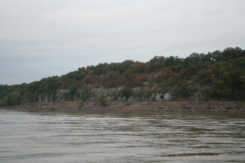
Limestone cliffs along the Mississippi
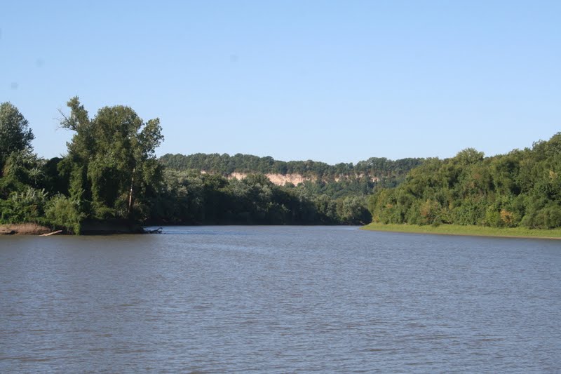
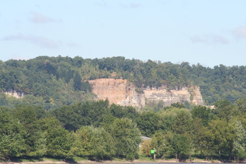
Interesting formations
Arriving at the Mel Price Lock and Dam
Mel Price lock
The next morning we were up early ready for our run down the first leg of the Mississippi. The goal was to make it to Hoppie's Marina in Kimmswick, MO, about 20 miles south of St. Louis. We had 60 miles and two major Mississippi locks to go through. If we encountered tow traffic at the locks, it could be a long day. While there are some marinas at the first stretch of this run, there are no facilities for recreational boaters in the vicinity of St. Louis. Although they had a slower boat, Mike and Denniese decided to go with us. We left Grafton at sunrise and immediately entered the Mississippi River. With the engines a little above idle speed, we were doing 9-10 knots down the river, because of the 3-5 knot current. The upper Mississippi is very scenic with river-carved limestone cliffs along the banks and we had an easy ride to the Mel Price Lock and Dam. This is a very busy lock for commercial traffic with 30 percent of the world's grain (are U.S. farmers amazing or what) passing through it. Lady luck was with us and we only had to wait for a tow with no barges to finish locking through when we arrived.
Wheee! We meet the Missouri
They aren't kidding!
Coming to St. Louis
Just beyond the Mel Price Lock we met up with the Missouri River. At this confluence our speed shot up to over 12 knots and the water became very turbulent. Capt. Larry was so busy shooting pictures, that he almost missed the Chain of Rocks Canal that bypasses a very turbulent section of the Mississippi. There is a waterfall in this section at a low water dam over which a 44 foot trawler passed and sunk, at the base of the fall, and is still down there. Glad we weren't the second boat! In the canal the current subsided an we cruised leisurely to our second lock, the Chain of Rocks Lock. Again we were fortunate in our timing with a large tow exiting the lock just as we arrived. The wind was blowing hard and Lifestyles II was having a difficult time getting tied up to the wall. He started to starboard, then decided to switch to port at the last minute which caused him to get sideways in the lock. He was all over the place and having trouble when the lockmaster closed the gates and started to empty the chamber. He tried for a starboard tie again when Capt. Larry yelled at him and told him to just float in the center, because we were going down 24 feet. Mike had a hard time controlling his single-screw trawler in the wind, but chamber emptied and the gates opened just before he ran out of room! We exited the lock and followed the canal to where it rejoined the river just north of St. Louis. Our speed shot back up as we entered the current and we were again "rolling down the river."
Gateway Arch
Picture perfect!
St. Louis does not have the prettiest water front with all of the commercial terminals, but the Gateway Arch and the buildings and skyline did provide some photo ops. It was challenging, though, taking pictures and dodging tows and anchored barges along the way. All along the river there are wing dams and weir dams to control erosion and water flow. These dams can project above the surface of the water, be just below the surface at running gear depth, or be deep enough that boats can pass over without hitting them. In any event, these structures require strict attention to running in the channel. As we were coming down the river, we noticed that Lifestyles II had a tendency to run outside the channel where the current was less, but the wing dams were present. Capt. Larry thought about a yell out about the wing dams to Mike, but figured that since he was just a few days from completing their loop, he was aware of the hazards. We continued flying down the river arriving at Hoppie's in the early afternoon. Getting into Hoppie's was tricky. We had to go past it about a quarter mile, then turn up into the current and ease our way to the fuel dock. It was white-knuckle docking, but Fern Hopkins and husband Hoppie were very experienced at handling the lines and guiding us in. We topped off with fuel and got the boat secured at the dock then got off to meet the other boaters there.
Attending Fern's seminar
All happy at Hoppie's
Fern autographs Hoppie's pic in guide
All lined up at Hoppie's
Among loopers, Fern and Hoppie are legendary. Because the Mississippi River is almost exclusively geared to commercial traffic, the clientele that patronize Hoppie's Marina are largely loopers. The marina is the last gas stop and only marina for 238 miles to Green Turtle Bay in Grand Rivers, KY. Since there are no marinas or anchorages in the St. Louis area for recreational boaters, everyone stops at Hoppie's. Fern and Hoppie are also a fountain of river knowledge that they share with loopers every afternoon around 1700. Fern gathers everyone around and tells them what and what not to do further down the river. She warned about wing dams in certain areas that cause considerable turbulence, and even whirlpools, and how to negotiate them. She talks about how to interact with and pass the large tows that navigate the river, and also tells you where to anchor and how to get into the anchorages. She is no nonsense, straight talking, and we found her descriptions and advice to be right on the money. After talking with the four other boats that were docked with us, four of us decided to leave early the next morning as a group to make the 111 mile run to an anchorage in the Little Diversion Channel near Cape Girardeau, MO. Lifestyles II decided to go alone and stay at some closer anchorages.
Leaving early
Bye, bye Hoppie's
River scenery
We meet a whirlpool and turbulence!
Trying to avoid the whirlpool
Meeting a 6 x 5 tow
Tree stuck on a wing dam
Tower Rock
Passing a 6 x 6, they just get bigger!
Coming into Little Diversion Channel
We arrive at our anchorage
The next morning four boats pulled out of Hoppie's at first light. Fred and Julaine Eddy aboard Boreas, Doug and Barb Caddaro aboard Tropical Breeze, and John and Rita Holman aboard Brandy IV. It was an experience leaving with so little light and being caught by the current and whisked downstream. The trip was uneventful until we got to the first trouble spot that Fern had warned us about. Here the river made a sharp 90 degree turn and the wing dams caused so much turbulence that we were facing 2-3 foot waves, whirlpools half the size of the boat, and really fast current that rocked the boat from side to side. Thankfully, there were no tows in the area, because we weren't really sure how we would have passed them. We continued on dodging the tow traffic until we got to our anchorage. Because of the current, getting into the anchorage was going to be tricky, but Capt. Larry followed Fern's advice and went downstream about a quarter of a mile and beat back up against the current. To keep the current from pushing him into the bank, he kept the port engine revving about 1000 rpm's faster than the starboard engine giving him a lot more control. We made it into the anchorage and got the hook set. We enjoyed happy hour by ourselves on then boat and then grilled some pork chops for dinner. We kept an ear out for some predicted thunderstorms, because our anchorage was a storm drain for the town of Cape Girardeau and was susceptible to flash flooding if it rained hard. Fortunately it just sprinkled during the night!
The I-57 bridge
Meeting the Ohio at Cairo
Up the Ohio we go
New Olmstead Lock under construction
Lock 53 under water
Passing over the Lock 53 dam
Lock and dam 53 at high water
A 6 x 6 with 4 on port side (40 barges!)
Going over our second dam
So this is retirement!
The next morning the four boats left again at first light. Two of the other boats were talking about anchoring that evening in more exposed areas of the Ohio River, but Capt. Larry argued that we should be able to put in a long day and make it to the Cumberland Towhead at the mouth of the Cumberland River. None of the anchorages the other captains were considering showed much safety in his mind, and he was determined to go to the towhead with or without them. To make it to the towhead we would have to travel 109 miles with 48 miles downstream on the Mississippi, and 61 miles upstream on the Ohio. The Ohio River was also up considerably, so the current would be stronger than normal. The silver lining was that two Ohio River weir locks had their gates down and we could pass over the dams without locking through the locks. This would save at least an hour's time (or more). To make this happen we would have to travel even faster with the downstream current on the Mississippi than we did the day before. And away we flew! Along the way we went under the I-57 bridge which we cross over every year on our trip to the Indianapolis 500. For the past two years we thought about passing under the bridge as we did the loop, and here we are. We made it to the mouth of the Ohio River by 1030 then turned up the Ohio. Our speeds dropped around 5 mph to a snail's pace 8 mph. There was also a lot of tow traffic that we had to watch out for. We crawled our way up the Ohio with the engines around half-throttle. We got to our first lock and radioed the lockmaster who told us to just drive over the dam (we didn't even have to slow down). We looked over at the lock and it was completely under water! We passed the second lock the same way. Capt. Larry noticed that some of the bars that the other captains had considered as anchorages were under water, so the towhead was going to be it for the night. We got into the Cumberland Towhead around 1700. As we were coming in, we heard the Coast Guard exchange with a boat captain on the Mississippi that was in distress. It turns out that it was Lifestyles II who had run aground about 10 miles from the anchorage we had left that morning. Because of the distance, we could only hear the Coast Guard's side of the conversation so we weren't sure what the full story was. Our three boats were joined by a fourth looper, Floyd Walpole and Linda Hoobler aboard Tumbleweed from Wichita, KS. What a relief to be in this anchorage! We hollered out to the other boats, had a drink or two, and made something easy for supper.
Heading up the Cumberland
Cumberland River scenery
Barkley Lock and Dam
Up 54 feet!
Closing the gates
Almost there
Lake Barkley- we made it!
The next morning we had about 30 miles up the Cumberland River to the Barkley Lock and Dam to get onto Lake Barkley and our marina at Green Turtle Bay. Tumbleweed got a really early start and the remaining boats left around 0800 with Boreas in the lead. We had a scenic and leisurely cruise all the way to the Barkley Lock where Tumbleweed was waiting for use. We no sooner arrived at the lock when the lockmaster opened the gates and allowed us in. This was our biggest (up 54 feet) and newest lock on the trip. We exited the lock into Lake Barkley and had a two mile run to Green Turtle Bay. It was such a relief to be here and it felt that we had finally arrived at the oasis that we were striving for for the past 3 days. Jane was particularly happy to plant her feet on terra firma as they had not touched land for almost 60 hours! We got the boat secured in her slip and everyone enjoyed a major happy hour aboard Tumbleweed, before we were picked up and taken to dinner at the world famous Patti's Restaurant. Patti's is renowned for its 2-inch thick pork chop and desserts. It was a great evening and everyone had a good time.
We left Havana and Tall Timbers Marina on Labor Day. We had 120 miles to go to Grafton, IL and the Mississippi River, so we decided to do this in two days. Trouble is, there really aren't any marinas to pull into on this lower stretch of the Illinois River. This meant we would be anchoring on the river somewhere for one evening, then moving on the next day to Grafton. We figured we would split the distance in half, so we headed out fairly early to cover the 60 odd miles plus a lock to our anchorage. We had great weather with temperatures in the low 70's, but it was fairly breezy. Since this was Labor Day, we encountered a lot of fishermen and campers along the river and had to slow down several times so we didn't wake them. We came to our last lock, the LaGrange Lock, on the Illinois. We had to wait approximately 20 minutes for a tow to finish locking through before we could enter. The lockmaster called us and told us to just float in the middle of the lock which only went down 10 feet. The problem was we had a really stiff wind on our tail and it was all Capt. Larry could do to keep her centered. We no sooner exited the lock when the starboard engine temperature alarm went off. Deju vu all over again! We shut the engine and Jane took over the helm while Capt. Larry went below to see what was going on. Same as before, the raw water strainer was emptied. We proceeded on one engine and tried a couple of times to restart the starboard engine which always overheated. We would have to wait until we stopped to find out what was going on. The lower Illinois River is very different and much more scenic that the upper part. The terrain next to the river becomes hilly with limestone hills and buttes all along the way. We me a group of speed boaters that we thought might be racing, but after they passed us we figured they were just out for a fast holiday ride. On this leg we passed two tows which is always interesting. The channel is relatively narrow and the captains instruct you how to pass. But it seems to take forever to get around them.
Going into our anchorage
Limestone cliffs along the river
Add caption
With a relatively stiff northerly breeze, Capt. Larry passed up two recommended anchorages, because of their exposure and his recall is a similar situation in the Little Alligator River in North Carolina. The second anchorage was at a dual highway bridge that was the western most point of the loop at W 098 38.7652. On the third anchorage, Jane was all go, but Capt. Larry didn't think it provided enough swing room. Two miles later, we found our spot. We were able to get well out of the main channel and would be somewhat protected with decent depths at Buckthorn Island. We dropped the hook and Capt. Larry went below to assess the overheating problem. When he pulled the raw water pump apart, he found the impeller was shot. He is so good at changing out impellers that he would probably win a NASCAR pit competition for impeller changing, if they had one. With a spare impeller he was able to fix the problem in about one-half hour, but why this happens still is a mystery, but we are starting to associate it with turbulence from prop wash or heavy seas that causes air to enter the raw water system. Why it only occurs on the starboard engine, however, is puzzling. We had cooked some red beans and rice while we were in the marina, so all we had to do was reheat them for our dinner. We started up the genset and watched another of Todd's movies, then turned in early. We were well away from any city lights and the night sky was exceptionally starry and clear. It was magnificent! During the night two tows came by our anchorage and shone their light on us and the shoreline. It was sort of eerie to watch the tow's lights light up the river.
High, and hopefully, dry!
Ready for duck season
Car ferry near Grafton
We got up early the next morning and almost immediately got underway. It was another beautiful, but breezy, day. As we got near Grafton, the river started to take on characteristics of the Mississippi. It became broader, deeper, and the houses built along the shore were significantly elevated to avoid springtime flooding. The river was also lined with limestone cliffs that are characteristic of the upper Mississippi. As we approached the Mississippi the Illinois River also became more meandering with large bends and turns. We had reserved a slip at Grafton Harbor which is a new marina built in 2006. The facilities are nice and the marina staff was very helpful. We also found John and Mary Leatherman on Mary Fraces IV in the slip next to us. Small world!
We got a late start leaving Chicago. The plan was to take the Chicago River through downtown Chicago to the Chicago Sanitary and Ship Canal, then into the Des Plaines River. Our friends on P-dock had been talking about a certain railroad bridge on this route that didn't open during rush hour traffic, because of the commuter trains. Some reported waiting up to two hours at this bridge. This really presented a dilemma for us, because we needed to get an early start to reach our intended destination just beyond Joliet. We also had two locks we had to transit and the commercial traffic could present delays at the locks. We had morning coffee with the "P-dockers" thinking we would arrive at the bridge after rush hour traffic, but an experienced captain informed us, just as we were thinking of leaving, that we could still experience up to an hour's wait at the bridge. Capt. Larry decided at the last minute to alter our route and go to Calumet Harbor and take the Calumet River and Calumet Sag Channel to the Des Plaines River. We wouldn't get to experience the thrill of cruising through downtown Chicago and would have to contend with lots of commercial traffic through a heavily industrial area, but we hopefully wouldn't have any major delays. When you have to travel at basically no-wake speed, any delay can add considerable time to the itinerary.
Busy fleeting area
Barges from exotic places
Tight squeeze at lowest bridge on loop
A really shocking place we passed!
Boy, do we LOVE floating bollards!
Down 40 feet at Lockport Lock
Ready to leave the Lockport Lock
We worked our way through the CalSag Channel until we came to the junction with the Chicago Sanitary and Ship Canal at the Des Plaines River. Then the fun part began. We entered a towboat and barge fleeting area that stretched for the next five miles. The channel is narrow and barges are parked to one side or the other of the channel. If we encountered any commercial traffic, we would have to duck between parked barges and wait for the traffic to pass. We were fortunate in that this only happened to us one time, but it seemed to take forever to run this section at idle speed or slower. While we were in this area we went under the lowest fixed bridge (actually it's a swing bridge that no longer opens) on the loop at 19.1'. If you can't clear this bridge you cannot do the loop. You can travel to here and turn around and travel back around to the other side and call that your loop, but you have to be able to clear this bridge to do a continuous route. We made it through this area only to face the one-half mile long electrical barrier designed to prevent the entry of the invasive Asian carp into the Great Lakes. We radioed the Coast Guard as instructed, but received no reply, so through the barrier we proceeded. The electric current had been recently increased and we weren't sure what to expect. Jokingly, Capt. Larry wanted Jane to handle the metal helm wheel through the barrier, but she would absolutely not touch anything metal. With an eye on all of the gauges for signs of something going awry, we made it through the barrier. Five miles further downstream we encountered our second lock, the Lockport Lock and Dam. We had to wait about an hour for an upbound tow to lock through, before we could do our thing. With this delay and the added distance from altering our route, it was obvious that the additional two hours to the recommended marina was going to be too much for one day. We decided instead to tie up on the free wall in Joliet. This turned out to be a good decision, because we were there with three other looper boats. We had met a lady named Carol while we were on P-dock who lived near the marina (and Joliet) we had planned on going to. After we were tied up we got a call from her wondering where we were. When we told her that we had to alter our plans, she showed up at the boat in Joliet with friends who had done the loop a few years ago. We sat on the park wall and had drinks until well into the evening.
Carol waving on her dock
Barges tied to trees
Rafted to Mary Frances IV in Ottawa
The next morning we left with two other looper boats and made our way downstream. We passed Carol's place on the river and she was out on her dock screaming at us and cheering us on. The two other boats we were running with decided to pull into a marina to fuel up. We didn't need fuel, so we proceeded on by ourselves and locked through the Dresden Lock and Dam. Further on we were passed by a boat, Mary Frances IV, that we had met when we were in Benton Harbor/St. Joseph, MI. We made our way to Ottawa, IL and intended on tying up at the Ottawa free dock for the evening. When we got there, there was no space available, but Mary Frances IV was tied up and John and Mary Leatherman invited us to raft up to their boat. This was our first experience in rafting, but something we will probably be doing more of as we run the inland rivers. We got off the boat and walked to town. We found a grocery that would give us a ride back to the boat, so we did a major reprovisioning of the stores. We invited John and Mary aboard Bavarian Cream for happy hour, then turned in for an early start the next morning.
Starved Rock State Park
Starved Rock butte and lock
Starved Rock
Jumping Asian carp
Leaving Ottawa, we went through a beautiful section of the Illinois River around the Starved Rock State Park and the Starved Rock Lock and Dam. According to a native legend, a group of Illini Indians were pursued by Ottawa and Potawatomi enemies and fled to a butte overlooking the Illinois River in the late 18th century. The Ottawa and Potawatomi besieged the butte until all of the Illini had starved, and the butte became known as Starved Rock. The butte is now a national historic landmark. We quickly locked through the lock and pressed on to the Henry Harbor Marina in Henry, IL. During this leg we saw our first Asian carp that would leap from the water when boats approached. Some of the smaller boats would purposely rev their engines to stir the carp up. We weren't sure if they were using some type of fishing method to catch them, or if they were just having fun. These fish are just thick and it is easy to understand why they are such a concern. We joked that they needed to import some Cajun fishermen from Louisiana and tell them how good the carp are or how much money they could make selling them to the Chinese. Problem solved! We cleaned up and had happy hour in the marina's bar/restaurant with our favorite northern appetizer, fried green beans. We went back to the boat, had supper, then watched another of Todd's movies.
Duck blind on the Illinois River
Navy ship with escort
The scenic Illinois River
The next morning we left for Peoria. The trip was uneventful until we almost got to our destination. We encountered a large navy ship and escort in the channel just as we arrived at the Illinois Valley Yacht Club. The ship was huge and seemingly out of place on the river. We pulled over to the side of the channel to give her plenty of room when the escort boat pulled up between us and the ship. Totally unnecessary assholes! All that maneuver did was reduce the amount of space the boats had in the channel. Sometimes this security crap gets a little out of hand. We also have a radio and a call to us we would advise you of our intentions. We heard that this ship was on its way to Henry where we had started the day from. Anyway, we got into the yacht club and got secured. This club has absolutely fine facilities and when Jane checked us in she made reservations for dinner. It was hot, so we enjoyed the club's swimming pool while the boat cooled. We cleaned up and had happy hour in the club's bar, met the commodore who bought us a round of drinks, then we went to the restaurant for a wonderful meal. We had wanted to stay an extra day here, but a major front was predicted to come through the area on Saturday, so we thought it best to move to our next destination ahead of the storm and wait the weather out there.
Kamikaze carp on the dock
Lynette catches a nice largemouth
More jumping carp
Jane catches a crappie
Jane with her largemouth
Jane and Lynette knocking 'em dead
All in an afternoon on the Illinois River
We left early the next morning to avoid running in the hottest part of the day. The area was experiencing unseasonably hot conditions with heat indices approaching 105 degrees. We were delayed about an hour at the Peoria Lock and Dam, because the lockmaster was having difficulty getting the upstream lock gate to open to let us in. After filling and emptying the chamber three times, the gate finally opened and we locked down. With the exception of passing a couple of really large tows, we had an uneventful run to our marina in Havana, IL. However, getting into the marina was really something. The entrance channel was only about 20 feet wide and when we got into the basin the depth sounder was showing 0.0 feet! We did get into our slip, but not before stirring up the Asian carp which were leaping all around us. One carp leaped onto the dock and just laid there, unable to get back into the water. Stupid fish! We noticed several of the boats that were moored in the marina had dead carp on their decks. Must be a mess to clean up. This is really a nice place with the downtown area a short walk away and the Tall Timbers Marina having really nice accommodations. Immediately after docking, Jane took off to do some shopping and scout the town out. When she returned to the boat we grilled some pork chops and corn-on-the-cob, had dinner, watched another of Todd's movies, and turned in for the evening. The next day we did some boat chores, Jane went shopping again, and looked for a bar/restaurant that would have the LSU vs. Oregon game on. We found a bar with a TV that would have the game on. We ate at Babe's which everyone from Chicago on down had recommended, then went to the Stag Tap a few doors down to watch the game. The bar was loud and by half-time it was time to head back to the boat. We listened to the second half on the satellite radio then turned in for the evening. The next morning the marina had coffee and cake for us. We chatted with Lynette who served as dockmaster in the owner's absence. She was catching some nice fish right at the dock. Jane jumped in and also started to catch some really nice fish. Jane went shopping one more time and Capt. Larry chilled out on the boat and worked on the blog. In the evening we bought pizza to share with Lynette and had a nice time.