Sunday, October 24, 2021

We Finish Our Journey


While studying the map to plan a route back home, we noticed that there are four areas surrounding Las Cruces that make up the Organ Mountains-Desert Peaks National Monument.

Approaching the Organ Mountains

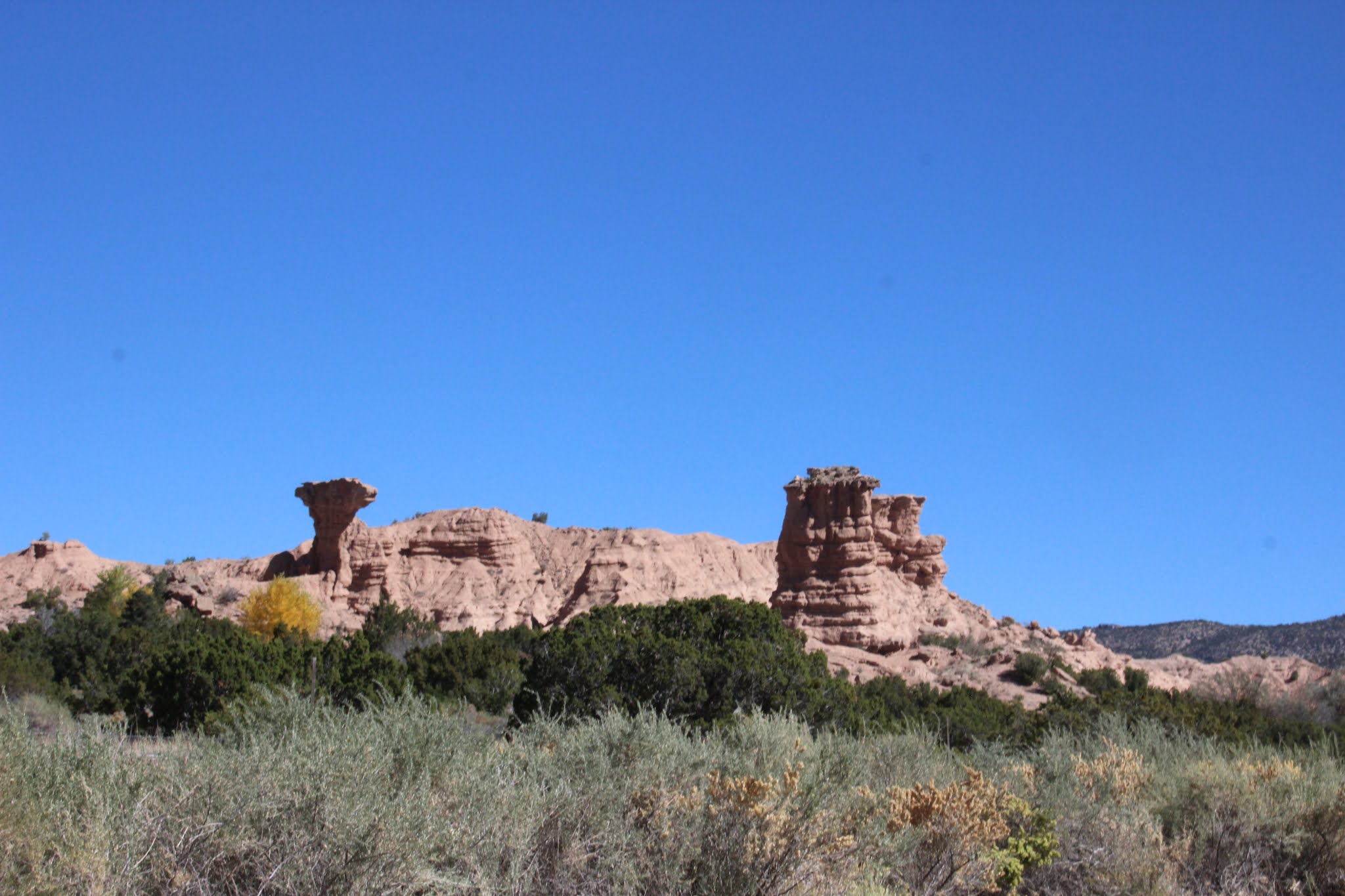
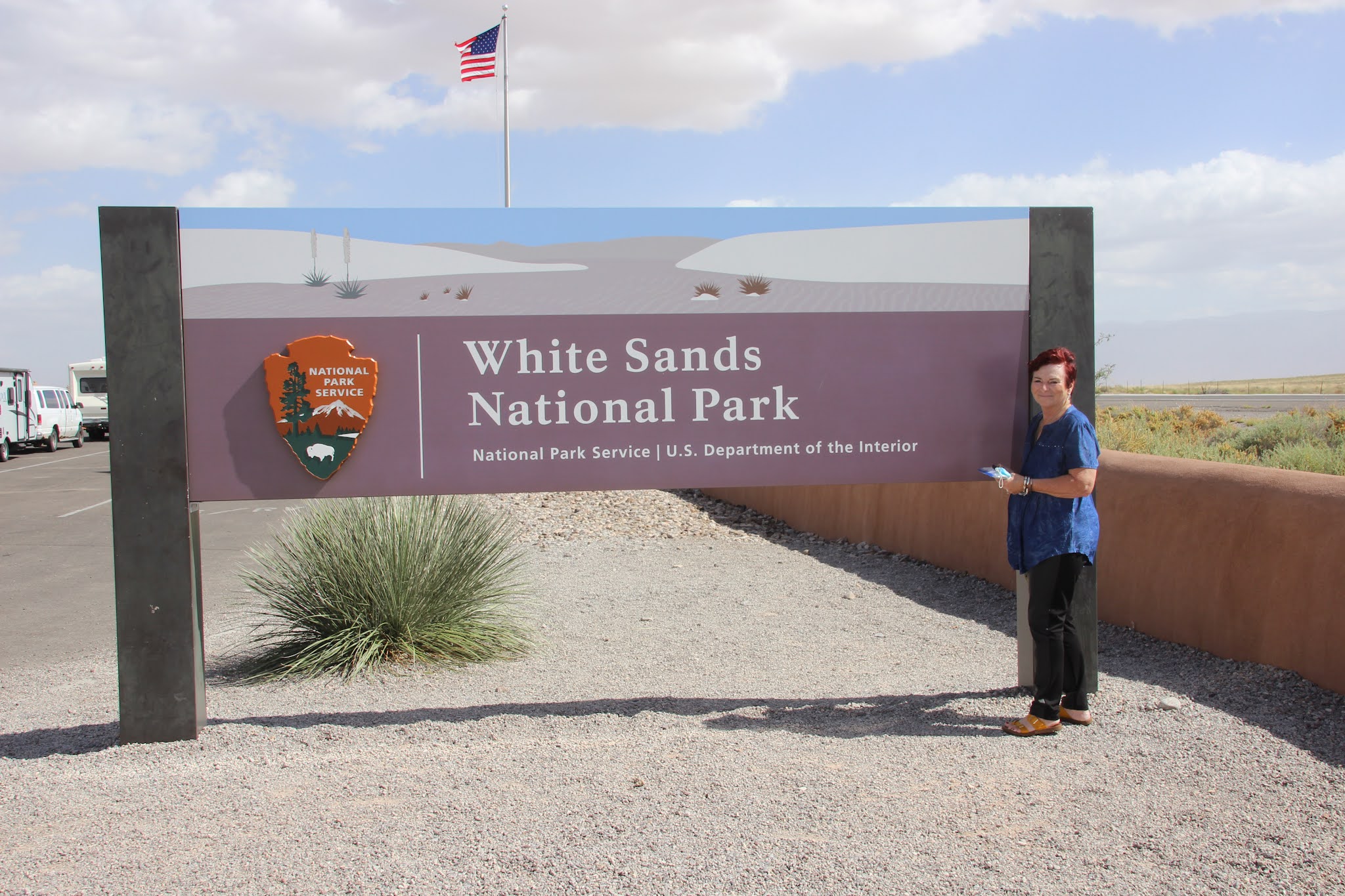
Never ones to pass up a national monument, we decide to pay this unit a visit. Established in 2014, this monument is not organized under the National Park Service like other national monuments we have visited. Instead, it is managed as a national conservation land under the Department of the Interior/Bureau of Land Management. We decide to visit the Organ Mountains area to the east of Las Cruces about 10 miles away from our motel.
We're heeeere!

The Organ Mountains are a steep, angular mountain range with rocky spires that jut dramatically above the Chihuahuan Desert floor to an elevation of 9,000 feet. We arrived at the visitor’s center, collected the stamp (naturally!), and viewed the center’s exhibits, before going outside to get some pictures of the mountains. Our visit was
Majestic peaks
a short one as the activities are pretty much limited to trail hiking—something we don’t do.

We leave the monument, find our way to the interstate, and in a short time we are at the Texas border. It’s so good to be back in TEXAS! We found New Mexico to be very constraining with its maximum 65 mph speed limit, incessant reduced speed zones, and ubiquitous mask mandates.

Main street in Fredericksburg

Texas frees one up to drive 75-80 mph and not have to wear a damn mask everywhere one goes. The only downside to being at the Texas border is that there is a hell of a lot of driving that has to be done to get to the other end! Cruising along I-10, we stop in Van Horn to have lunch and realize that this is the day and place that Jeff Bezos’s Blue Origin Aerospace launched William Shatner and crew into space.
Fredericksburg library

What a coincidence that we should pass through here on this day. We continue on the interstate and make our way to Fort Stockton where we will spend the night. We had visited Fort Stockton back in 2007 when we did our around-the-country motorcycle trip, and were amazed at all of the development that occurred in this community since then.

The next morning we are back on I 10 and cruise our way to an exit that will take us to the German-tourist town of Fredericksburg.

Former Fredericksburg hospital

This is our second visit to Fredericksburg and we find that the town is much quieter on a weekday than our previous weekend visit. Parking spaces aplenty, we parked the minivan and got out and walked Main Street so that Jane could shop the shops. After going down one side of the street and up the other, we returned to our van and headed to our destination for the night in Marble Falls. Marble Falls is only about an hour’s drive from Georgetown, TX, where we will visit our dear travel friends Pam and Dayne Carlson for a couple of days.

Arriving at the Carlson’s, everyone is so excited to be reunited! We update each other with our latest news (mostly health!) and stories. Pam and Jane take off on a shopping trip and Dayne drives Capt. Larry around his farm to show him the extensive housing development that is being built on land that he had sold.

At the ROCK fundraiser

We returned to the Carlson home, meet up with Pam and Jane, have a delicious dinner, and then watch the Houston Astros win the first game of their MLB playoff series.

The next day the Carlson’s drive us around Georgetown showing us the sites and stopping at a donation store so Pam and Jane could see what treasures they could find. After a really great pizza lunch we returned to the house to get ready for the evening’s big event— a charity dinner and barn dance.

Dayne & Pam with some veterans

The charity named ROCK, Ride On Center for Kids (ROCK), is a nonprofit organization that provides equine-assisted services to children, adults, and veterans with physical, cognitive, and emotional challenges. ROCK’s participants see improvements in most aspects of their lives—from muscle tone, strength, flexibility and balance to cognitive, behavioral, communication and emotional improvements. Pam and Dayne had purchased two tables for this event and invited us to be their guests along with some PTSD veterans.
Dayne won his "Texas" gas can

We enjoyed a delicious Texas-style steak dinner with all the trimmings and an open bar. In the silent auction Dayne spotted a Texas-rigged (i.e. no environmental contraptions) fuel container that he wanted to carry fuel for his new mowing tractor. We wanted to make a contribution to the cause, so we told Dayne to put our contribution on the container. It worked and at the end of the evening Dayne got his gas can! There was also a live auction with big ticket items such as trips and vacations. At evening’s end it was announced that over $100,000 had been raised. If you’d like to know more about this charity, check out their website at https://rockride.org/. After such a delightful evening, we said our goodbyes to our friends the next morning and drove to our home in Louisiana. That’s all she wrote for this trip!


Saturday, October 23, 2021

A Bust in Santa Fe and #62!


We got up late the next morning, knowing that we had no real agenda to accomplish. The weather was cool in Eagle Nest and the early morning sun was melting the roof ice and dripping on our minivan.

Glowing aspens at sunrise

We went to breakfast and were engaged by the desk clerk who was totally blown away as we started to open up about our travels. After spending the better part of an hour highlighting some of our trips, we bid her farewell and finished packing the minivan.
A roadside fruit stand

From Eagle Nest, there are only two routes that lead to Santa Fe, and we chose what is called the High Taos Trail that wound its way through the mountains and was the more scenic drive. As we descended the mountains into the Santa Fe, Jane picked two landmarks that she wanted to visit.
¡No hay entrada!

The first was Nambรฉ Falls which was a recreational area on the Nambรฉ Indian reservation. We had a brochure that described this area, but we really didn’t have any detailed directions as to how to get there. The car’s GPS was a strike out, and Googling for travel directions just pointed us in the general direction.
Nambรฉ rock formations

We stopped at a casino where Jane got directions and we figured that our problem had been solved and we would be enjoying a picnic lunch at a picture-perfect waterfall setting. We found the reservation and the road leading to the recreational area, a full 8 miles from the entrance. We crawled through the reservation’s painfully slow 25-35 mph speed limit zones, only to arrive at a locked gate (why can’t they put this notice at the beginning of this drive??) stating the area was closed due to COVID. So that was a wash and we got to do the speed zones in reverse!


Jane’s other attraction that she wanted to see was the little Loretto Chapel and its Miraculous Staircase. This we were able to pull up on the GPS, and in a short time we located it. Unfortunately, so had another 10,000 people!

Sunrise over the mountains

It was Columbus Day and the church grounds were jam packed. We started driving around looking for a parking space crisscrossing our path, taking two trips through the municipal parking lot, and expanding our radius for over an hour.
Loretto Chapel

We finally found an open space that we thought we might be able to walk to the church, but when Capt. Larry plugged our location into the GPS, we were over 6 miles away. At this point Jane decided to throw in the towel. This would have to be something we did at a later date with reservations in a hotel within a few blocks of the chapel. It was early afternoon, so we decided to find a motel for the night and head for our national park the next day.


When we are traveling, we seldom pay close attention to the local weather forecasts, because we are never certain of the broadcast area relative to our travel area.

We made it!

However, we probably should have had a better idea of the general weather conditions the next day. Leaving Santa Fe, we decided to skip the interstate and take less traveled back roads to the southern part of New Mexico where White Sands is located.
#62 in the book!

A strong wind was blowing as we left which increased to gale-force strength by the time we had driven halfway and stopped for gas. Road construction for several miles put us in a “straw out” from blowing straw that had been spread along the roadside to apparently hold seed or dirt in place. That wasn’t going to work with this wind! After the straw came the tumbleweeds which were a real rarity for us.


Arriving in Alamogordo around noon, we decided to visit the park and then drive to Las Cruces to spend the night.

The sand certainly is white!

The parks picnic areas were abandoned due to the high winds, so we had our picnic lunch in the van. We snapped some photos outside the visitor’s center, then went inside and put stamp #62 in the book. We were whole again!! The crusade would be paused! We watched a 20-minute video about the formation and ecology of the park, then perused the gift shop. We bought some postcards for the grandkids and stamped them with the park’s stamp. We also bought and stamped a park patch to send to the niece of our dear, deceased friend, Dr. Diane Pick, who was such an inspiration to us over the years in reaching our national park goal.
Driving through the park

Diane had been to White Sands as a national monument, and she was in our thoughts as we visited the park.

We left the visitor’s center to drive the 8-mile loop through the park that would pass by various trailheads, alkali flats, and picnic and camping areas. Unfortunately, the blowing wind and near blizzard-like conditions kept us from seeing much more than the road. Capt. Larry did attempt to take some pictures of some kids disc-sledding down a sand dune.

Kids sledding on the dunes

Rolling down a window to get a shot immediately put a fine layer of sand on the dashboard. So there wasn’t going to be a lot of picture taking! Wanting to see what the sand felt like, he got out of the van and grabbed a handful from a nearby pile. Being pelted with sand, he was back in the van in less than 20 seconds. The sand is not silicone, but gypsum (calcium carbonate) which originated from an ancient shallow sea that once covered the area. The sand is very fine—much like talc. We finished our drive and noted that the park service must have “snowplows” to keep the road open from the drifting sand. We found a room in Las Cruces and learned that night that the wind we experienced was due to the wind field from Pacific Hurricane Pamela that was coming ashore in Mexico. It wouldn’t have changed our plans, but would have helped us understand what we are up against.


Headin' out


Thursday, October 21, 2021

A New Mexican Oktoberfest


It’s Sunday morning and we slept in late. Looking out the window, Capt. Larry realized that it rained last night. As we are getting ready to go to breakfast, Jane went out to get some things from the minivan and came running back in agitated that the door handles had iced over.

Brilliant Fall Aspens

Welcome to North country! Our plans were to mosey around some of the local Eagle’s Nest businesses and maybe find a nice little restaurant for lunch or dinner. At breakfast we struck up a conversation with a couple from Amarillo, TX, who told us that they come here every year to the neighboring community of Red River for Oktoberfest.
The Red River Community

They informed us that the festival was continuing through Sunday. Jane was excited and felt that we should travel the 17 miles to this ski resort community to see if we could partake of some of that German fun. It had stopped raining and the temperatures were above freezing so we decided to give it a go.

We started out with clear skies and a gently rolling highway that deceptively continuously rose in elevation.

Red River's Ski Slopes

Approaching Red River, we were over 9500 feet in elevation and then started a precipitous decline down to the Red River community. We got there just before lunch time, and things were just beginning to open up. Jane spotted a couple of gift shops that she had to peruse, and as she was finishing up her shopping duties she said that it was beginning to sprinkle and that she was going back to the van to get an umbrella.
Here comes the snow! (background) 

No sooner had she left than Capt. Larry realized that it was not rain but snow, and the temperature was continuing to decline. Not expecting snow, Jane had only packed light jackets but made sure that the three she brought were all on her! We entered the festival and began walking around, but as with most festivals, it was mostly food and craft vendors offering their goods.
Snow in the mountains

The vendors came from a wide area and there were several craft beer tents that looked appealing. But the blowing wind was so cold that drinking beer just didn’t seem to be an option (nor eating ice cream from the poor ice cream vendor). A German oompah band started playing in a covered pavilion, so we decided to get us some lunch and enjoy the music. There was one authentic German vendor with awesome looking food and we made a selection of two sandwiches, one schnitzel, and one bratwurst with all the trimmings that we decided to share.
Mountain driving in the snow!

We moved to the pavilion and began eating when the band’s tuba player looked out and announced “here comes the snow.” We turned around and saw one hell of a storm descending upon us. Everyone at the festival crowded into the pavilion and for the next 15 minutes we watched what Capt. Larry considered to be near blizzard-like conditions envelope us. Everyone around us was drinking beer and having a good time, but Capt. Larry, having experienced similar storms in Minnesota (without the damn mountains!), had a gut feeling that it was time for us to go.
Eagle Nest Lake

And Jane had just made some good friends and was sharing her life story! But she sensed Capt. Larry’s concerns, so she said her goodbyes and we headed out. Going up the mountain the temperature remained above freezing so we were basically dealing with just wet pavement. But on the downside, the temperature dropped to freezing and slush started to form on the road. Jane started freaking out when the road turned white with sticking snow. We gingerly made our way down and in the valley the temperature started to rise above freezing with the snow returning to rain. Back in Eagle Nest, we drove around trying to find an access to Eagle Nest Lake, but could only get so close, so it would have to do. We went back to our room and hunkered down for the night, knowing that tomorrow we would be headed for Santa Fe and a different part of the state.

Oktoberfest in the snow!


Wednesday, October 20, 2021

We Revisit Our National Park Crusade

A Texas Panhandle Panorama

So, after a year and a half of dealing with COVID and the massive cleanup after the Hurricane Ida, we are traveling again. But nothing overseas, it’s all stateside.There are just too many hoops to jump through to do travel abroad! Fortunately, former President Trump gave us a reason to continue our crusade of visiting all the national parks. We had visited all of the national parks prior to his presidency. But he elevated three park service units to national park status towards the end of his term.We had visited two of these parks, New River Gorge National Park in West Virginia and Indiana Dunes National Park on the shores of Lake Michigan, after a visit to Capt. Larry’s aunt in New Hampshire to celebrate her 100th birthday. Unfortunately, we didn’t blog the visits to these national parks. But now we’e on #62, the final national park, and the former White Sands National Monument in New Mexico.

A Texan Welcome Sign!

We left our home in Killian, Louisiana, and drove the long and boring Louisiana I-49 corridor to Texarkana, TX, where we spent the night. An early start the next morning, we headed for Amarillo, TX, another full day’s drive.

A Beaut of a Butte


Following a route that took us along the Red River and through “Texoma,” we found this drive really interesting as Texans in this part of the state are really into cattle, horses, oil/gas wells and cotton fields. The changes in landscape from hilly country to Texas flatlands was really interesting, but the thing that impressed us the most was the incessant and strong blowing of the wind.
Got Tires? Need a Windbreak?

In this part of the country, we quickly learned that you only open one car door at a time! We saw several windfarms and windmills harness this wind power to generate electricity and pump water for cattle. We found a motel in Amarillo, but were unable to secure reservations for Taos, New Mexico where we had hoped to spend the weekend.
Another National Monument

We finally did find a weekend room in nearby Eagle’s Nest, about 31 miles of mountain driving away. Following back roads through the Texas Panhandle and heavily irrigated farmland country, we crossed over into New Mexico at Texline, TX. We got lost in Clayton (how you get lost in a 3-stoplight town is definitely concerning!) and continued on through the New Mexican low lands. As we were driving, we saw a National Park Service sign that we were approaching the Capulin Volcano National Monument. Not knowing anything about this monument, we decided to stop. This monument is a well-preserved, relatively young (55,000 to 62,000 years old), symmetrical cinder cone rising steeply from the surrounding grassland plains to an elevation of 8,182 feet above sea level.
The Palisades
The irregular rim of the crater is about a mile in circumference and the crater is about 400 feet deep. It is part of the 8,000 mi.² Clayton-Raton volcanic field.

Continuing on, we met the Rocky Mountains and Cimarron, NM. From here, the 30-odd mile drive through the windblown canyons became our next driving challenge. It was early afternoon when we arrived in Eagles Nest, so we checked into our motel and decided to do another 30+ mile canyon ride to Taos.

Colorful Aspens from Our Motel

Upon entering Taos, we immediately started to get bad vibes about this tourist attraction. Starting with the traffic, (which explains why we couldn’t find any motel rooms here) we crawled through the streets and finally spotted some parking spaces next to a restaurant that was highly recommended by our Eagles Nest motel manager.

¡No Hay Comida Hoy!


We got parked and as we approached the restaurant an employee was locking the door and said “Sorry, we’re closed.” It was 2 PM! We decided to walk around a square looking for another restaurant and shops for Jane. We were hungry and found the Alley Cantina after passing two other restaurants that were also closed. The Alley Cantina proffered a menu of Tex-Mex offerings which we enjoy. Capt. Larry ordered a beer that turned out costing $8.50 with a $5 beer for Jane. The Carne Avodado that we each ordered along with a Caesar salad (never had Tex-Mex with a Caesar salad which should have been a warning!) arrived on the same plate, and we quickly learned that Carne Avodado was Spanish for "Mexican gristle-meat" in a red chili sauce. We were so disappointed.
The Village Square

We paid our bill and went looking for some shops for Jane, but she was disappointed in that she was looking for shops with handmade arts and crafts and not factory-produced-in-China goods. And neither of us are into Mexican/New Mexican/Indian art and decor. We were also disappointed in the overdone Adobe architecture that pervades the town. It just had a certain degree of “fakeness” to it. So, we found our minivan and headed back to Eagles Nest, hoping that we could find some other fun things to do tomorrow. We went to bed disappointed that the overcast skies would not let us stargaze in this dimly lit place, but were thrilled at the howling of several packs of coyotes in the nearby hills.


¡Estรกn Muy Calientes!