If you've ever looked at a map of Michigan, you discover how huge the state is if you consider the land area plus its territorial waters. In land area Michigan ranks 22nd among the states, but add in its territorial waters which includes about one-half of Lake Huron and about 2/3 of Lakes Michigan and Superior, and that ranking jumps to tenth overall. This size, and the fact that Michigan is separated into the upper peninsula and the lower "mitten" by the Straits of Mackinac, causes Michiganders to regionalize their state for reference purposes. Thus weather forecasts are given for the "upper-lower" which refers to the most northern part of the lower "mitten." This can be further divided into regions east of Mackinaw City (i.e. along Lake Huron) or west (i.e. along Lake Michigan). So, for what it's worth, when we left Mackinaw City heading west, we were beginning to cruise the western upper-lower. Everyone got that (not that it's important!)???
 |
| Mackinac Suspension Bridge |
 |
| Our northern most point |
 |
| White Shoal light |
 |
| Gray's Reef light |
We headed west from Mackinaw City with good weather and conditions. We were about one-half mile from the Mackinaw Suspension Bridge and one-half mile from the marina when the port engine died for no apparent reason. With one engine running, Capt. Larry went below to determine what the problem was. He came up from below and Jane was all worried. He got to the helm and turned on the ignition and the engine fired right up. Seems that when he had drained the fuel pre-filters while in port, he forgot to turn the fuel back on! So off we go heading for our next destination, Beaver Island. Along the way, we passed a milestone by passing our northern most point of our trip. From this point on we would generally be heading back south towards home. Beaver Island is the largest, and most northern island in Lake Michigan, and the guidebooks all indicate that it is an interesting stop. To get there though, you have to navigate through Gray's Reef, a rather large expanse of rocky reef that is noted for its shallow depths and very rough seas when the conditions aren't good.
 |
| St. James Harbor light, Beaver Island |
The reef is about 20 miles from Mackinaw City and in a strong S or SW wind over the long fetch of Lake Michigan, the seas can easily build to 6-9 foot waves or higher. The problem, if one encounters such conditions, is that there is no place to go for refuge.
 |
| Meeting a freighter in Gray's Reef |
Although
Bavarian Cream could likely clear the charted depths on a shortcut through the reef, Capt. Larry decided that we would stay in the deep water of the shipping channels to play it safe (there are rocks down there!). We turned south into the Gray's Reef Channel just south of the White Shoal light and headed for the Gray's Reef light at the other end. Our luck, there was a coal freighter entering the 3,000' foot wide channel from the south. We got through the channel then turned for St. James Harbor and the town of St. James, Beaver Island's largest community.
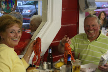
We got the boat into her slip at the Beaver Island Marina, then got our bikes down to scout out the town. Beaver Island is remote, naturally beautiful, and has a colorful history.
 |
| Beaver Island Marina |
 |
| Donnegal Bay, Beaver Island |
 |
| Front Lake, Beaver Island |
 |
| Toy firetrucks at the Toy Museum |
 |
| Toys at the Toy Museum |
 |
| Beaver Island public beach |
Beaver Island is probably most renowned as the hub of a faction of the Church of Jesus Christ of Latter-day Saints. This faction was founded by James J. Strang after the death of Joseph Smith who founded Mormonism. Strang moved his followers to Beaver Island supposedly to avoid persecution, but more likely to exert control over his followers. We find it ironic that a religious group that champions polygamy as one of its tenets would locate to a place called Beaver Island. Strang declared himself king of his followers (the Strangites) and the island has several roads and landmarks that are referenced by King James Strang. Strang was eventually assassinated and his followers were driven from the island, but they made a major impact on the island's development. For more information about the island and its association with Mormonism click on this link
Beaver Island. We rode our bikes all over the island and saw some pretty scenery. One of the attractions we were told not miss was the Toy Museum. We rode our bikes to this establishment and were amazed at what we found. Inside there were toys from the 1920's and 30's and perhaps even earlier. The museum runs itself through the sale of toys to visitors, and Jane paid her way with sales for the grandkids! It was a really neat attraction. Jane visited a few of the shops in town, then we donned our bathing suits and spent part of an afternoon at the harbor's public beach. While Beaver Island only has around 500 residents, we noticed from signs, bumper stickers, and license plates that they are fiercely proud of their community.
 |
| Deep water in Lake Michigan |
After two days on Beaver Island we left and headed back to the Michigan mainland, pulling into a marina in Petosky. Along the way we passed over water that was even deeper than what we encountered in Lake Huron at 280 feet. Petosky is another small lakeside town that we found to be very charming. The guides indicate there is a lot of businesses close to the marina. We set out to pick up some groceries and scout out a place to eat, only to learn that the guides neglected to inform us that while establishments were close by, there were some monstrous hills that had to be climbed to get to them! We were less than one-half mile from a Wal-Mart when Jane announced that she had had enough and we went into another grocery store and abandoned any ideas of purchasing anything other than groceries. We made our way back to the boat, but were too pooped to head out again. The next morning we strolled through downtown Petosky and had breakfast at a downtown restaurant. Rain was forecast and the skies were threatening so we went back to the boat for a rainy afternoon.
 |
| Unique architecture in Charlevoix |
 |
| Rough conditions on Lake Michigan |
 |
| Breaking surf at the lighthouse |
 |
| Kevin and Pam's POS ride in Charlevoix |
The next day the weather was good so we shoved off for a short trip to Charlevoix. We found Charlevoix to be even more delightful than Petosky with a renewed downtown and tourist area right next to the municipal marina. Jane was a happy camper with being able to visit so many shops and be only a short distance from the boat. Our plans were to spend two days in Charlevoix and then push on to our next stop, but on the evening of the second day a cold front moved through and the weather changed considerably. We awoke to find 20-25 kt. winds with gusts to 30 kts. The marina harbormaster suggested we walk down to the lake shore to get a look at the lake conditions. We watched 3-5 foot waves break on the waterfront and returned to the boat to hear reports of 6-9-foot seas out in the open water of Lake Michigan. It definitely was not going to be a travel day. We got our bikes down and biked around the outskirts of town, then returned to boat and relaxed for the afternoon. Being on Lake Michigan this time of year the rule of thumb is to allow one weather day for every two travel days. Hopefully we will get a break in the weather and will be able to leave tomorrow. The again, extending our stay in Charlevoix wouldn't really disappoint us terribly.


No comments:
Post a Comment