Green River is fairly close to the Utah/Colorado border and
we headed that way the next morning. Almost immediately after we crossed the
border we noticed a change in landscape
from the relatively barren, but colorful, sedimentary rock mountains in Utah to
the alpine conifer forests that blanket Colorado’s granitic mountains.
 |
| Transitioning to CO mountains |
We also
started to increase our altitude rather dramatically. We stopped in Grand
Junction to refuel and made our way to the popular ski areas of Vail, Beaver
Creek, Breckenridge, and Aspen.
 |
| Vail ski slopes |
As we passed through the Vail Pass our altitude
increase to over 10,000 feet. The mountain views were impressive, but we still
favored the colorful beauty of Utah.
 |
| Ski resort |
We arrived in Denver fearful that we would
get caught in rush hour traffic, but even though we had to slow down
considerably as the traffic volume built, we avoided any jams and were through
that city in reasonably good time.
 |
| Rocky Mountain high |
Just past Denver the landscape changes
abruptly to the rolling foothills of the Rocky Mountains, and land utilization
reverts back to agriculture and ranching. We were pressing our drive in an
effort to get into western Kansas and a time change back to Central Daylight
Time, so as to not lose an hour as we started the next day.
 |
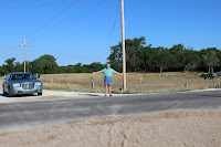
| We're on the right road |
When we got to
Colby, KS, however, we decided to check into a motel as we just didn’t want to
go any further, and we were just a short distance from the time zone change. Jane was driving the next morning and Capt. Larry was
perusing the road map when he noticed a small town marked on the map named
Pfeifer, KS. Since that is the exact spelling of our last name, and it didn’t
appear to be too far out of the way, we couldn’t pass up a visit.
 |
| Could this be Pfeifer, KS? |
As we exited
I-70 at Victoria, KS, we spotted a large church that Capt. Larry must be
Lutheran for all of the people of German descent in the area. The German part
turned out to be accurate, but the church was Catholic. In fact it was a
Catholic cathedral named St. Fidelis Cathedral (Cathedral of the Plains) and
was proclaimed to be one of the 8 Wonders of Kansas.
 |
| St. Fidelis Cathedral |
We couldn’t believe that
we had stumbled upon this and we got really excited. Deciding to view the
church when we came back from a visit to Pfeifer, we took Pfeifer Avenue south
looking for the town. According to the map it was situated on the southern bank
of the Smoky Hill River, so we were looking for a stream.
 |
| The cathedral sanctuary |
Our atlas showed the
town on the map, but didn’t list it in the index, so we figured that it had
fewer than 500 people in it or perhaps was unincorporated, and we didn’t have
good data service so we could look it up on our phones. We drove about 4 miles
south of Victoria and came to an intersection by a stream that we assumed was
the Smoky Hill River.
 |
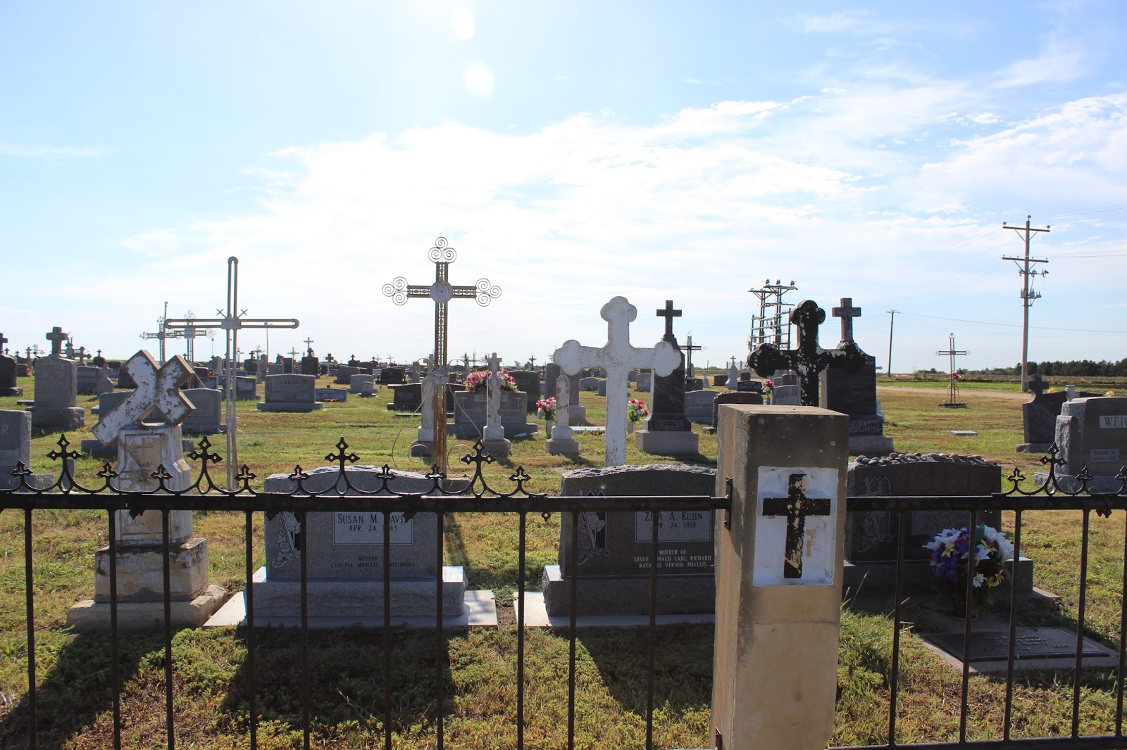
| Wolgadeutsche cemetery |
The distance looked right according to the scale on the
map. But there was no town- just a couple of farm buildings and not much else.
 |
| Volga iron crosses in St.Fidelis cemetery |
Figuring the town no longer existed, we took some pictures then drove a couple
of miles further south just to make sure we hadn’t missed. We turned around and
headed back to Victoria to see the cathedral. It was awesome and very well
maintained, but it almost seemed out of place in this very rural and sparsely
populated setting.
 |
| Michael, Larry, and Catherine Pfeifer |
Jane took some pictures inside the church but forgot to
reset the camera settings to take the indoor shots, so they didn’t turn out
very well. We enjoyed the architecture that mimicked that of the church in the
homes surrounding it. Just as we were ready to get on the interstate we spotted
the catholic cemetery. Jane spotted some markers that looked like those in New
Orleans and wanted to take some shots.
 |
| More beautiful markers |
As she was shooting, Capt. Larry saw
that some of the grave markers had very ornate metalwork which resembled that
found in aluminum screen doors and something Jane had missed completely. As he
pointed it out, we both became fully aware that we had happened upon a very old
ethnic cemetery. We took pictures of the markers, then drove inside to see if
we could find some bearing the Pfeifer name. Virtually every marker bore a
German family name and it was obvious that large sections were devoted to
single families. Toward the front of the cemetery we found the Pfeifers. And we
found some very old Pfeifer family markers. Two of the markers bore the name of
Michael and Catherine Pfeifer (both names in his family) who died in 1813 and
1819 respectively. Bear in mind that the Louisiana purchase occurred in 1803,
so these were probably pioneer settlers. Also, the Pfeifer name is a very old
German family name and is part of the language (we’re told it means “whistler”
or “piper”) so it is very probable the there is a common ancestry.
We left the cemetery amazed at what we had stumbled upon and
headed for Wichita were we had lunch and refueled. It was still early so we
planned to try and make Arkansas before stopping for the night. Our route took
us through Tulsa and then onto Ft. Smith where we checked into a motel. We
decided to find a local restaurant for dinner and went down to the old,
historic section of the city.
 |
| Beautiful clouds over Oklahoma |
Here we found a restaurant called “Sisters.” The
receptionist immediately asked us if we wanted to drink alcohol. We indicated
that we did and were then asked: “Are you a member of the club?” We had no idea
what she was talking about until she explained that it was a “dry” county and
we had to be club members. Thinking that we would have to forgo any drinks or
wine, she then presented a form that when filled out would make us club
members! So that’s how they get around the stupid temperance. One has to wonder
why have the law if there’s always a loophole. We had a nice meal, met the
owner, and left just as a musician (with a banjo!) was getting ready to play.
The owner begged us to stay, but we had had a very long day and elected to head
back to our room.
ADDENDUM: When we got home we checked out Pfeifer, KS with
Google and Google Earth. Turns out the town was not where we thought it was. It
is located about 10 miles south of Victoria and we only went about 6. So close,
but yet so far. It has a post office and zip code 67660. The 2010 census showed
81 people but the current estimate from the town’s database is 68 (it’s easy to
tell who comes and goes!). Here’s a table of demographic data from the 2010
census:
Estimated
Current Population:
|
68
|
Population:
|
81
|
White
Population:
|
79
|
Black
Population:
|
1
|
Hispanic
Population:
|
1
|
Asian
Population:
|
0
|
Hawaiian
Population:
|
0
|
Indian
Population:
|
1
|
Other
Population:
|
0
|
Male
Population:
|
45
|
Female
Population:
|
36
|
Avg
House Value:
|
$91,000.00
|
Avg
Household Income:
|
$32,396.00
|
Avg
Persons Per Household:
|
2.45
|
Median
Age:
|
43.30
|
Median
Age (Male):
|
47.50
|
Median
Age (Female):
|
36.00
|
We thought this was kind of fun. Here’s some links we’ve
found about Pfeifer for the few of you who are interested:


No comments:
Post a Comment