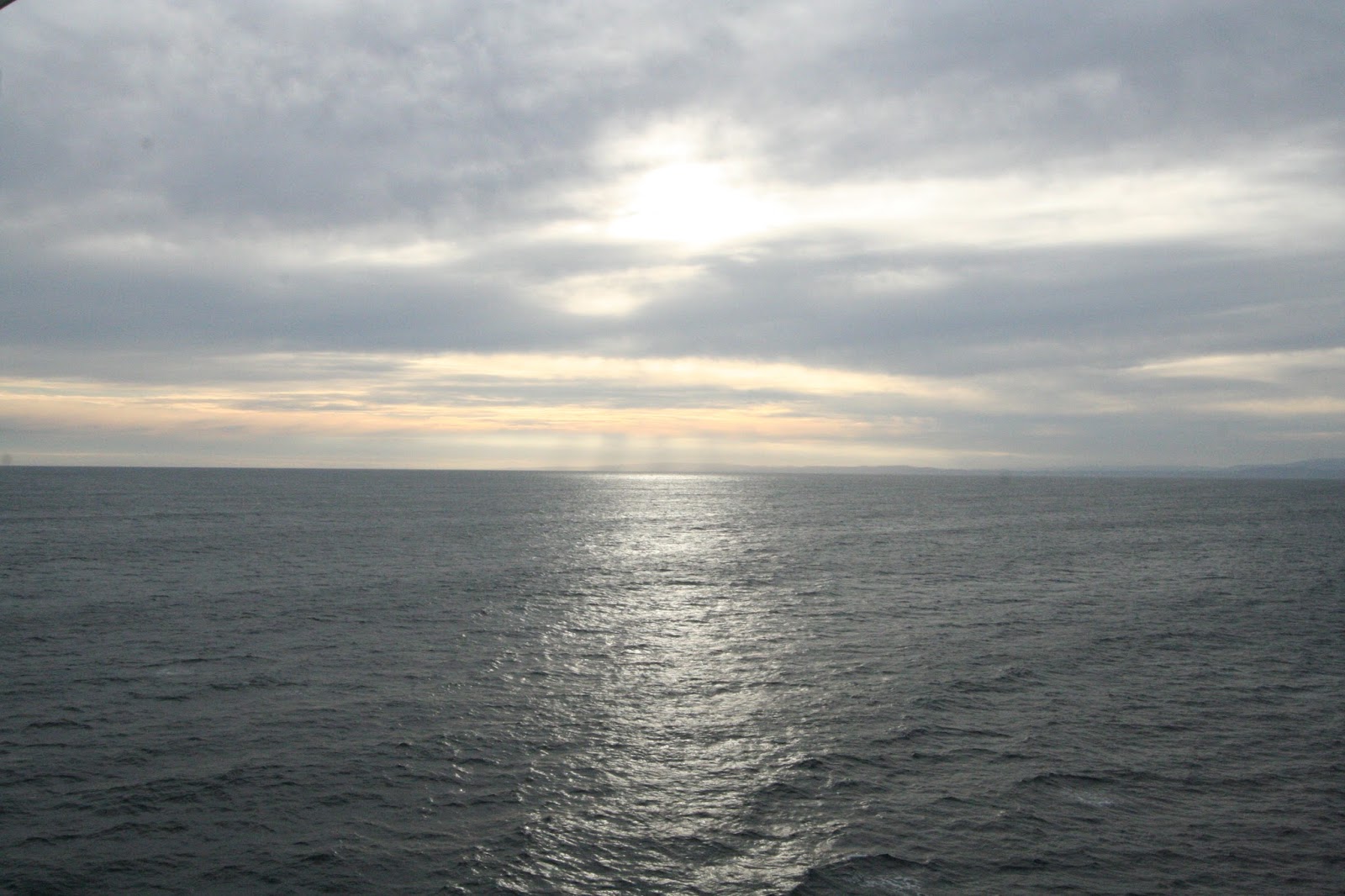
Our first day at sea was not good. As soon as we had passed
the headlands at the mouth of the Parramatta River, the seas started to get
rough.
 |
| Skyline & Opera House from the river |
By the next morning it was worse. We had 25-40 kt. winds with seas
around 10-12 ft., but what made it bad was that everything was coming from the
north and we were on an ESE course taking those big rollers right on the port beam
and rocking the ship back and forth hard. We saw several people with sea
sickness and wondered if that might not be misdiagnosed as gastrointestinal illness that had put the ship under norovirus sanitary precautions. We had heard that the staff were not reporting sickness like they often do in a norovirus outbreak.
 |
| The Tasman Sea was not kind to us |
To pass the time we explored the ship and Jane took some craft
classes (watercolor painting and jewelry making), while Capt. Larry worked on
the blog, organized photos, read, and watched football. These conditions
continued into the next day, finally abating by the afternoon of the third day
as the cold front passed and the winds shifted to the SSW.
 |
| Wellington's cable car |
Compared to our
crossing of the Drake Passage into Antarctica, we found the Tasman Sea to be
far more challenging. Of course, we also realize that we were really lucky in
the Drake Passage.
The morning of our arrival into Wellington, we were once
again experiencing really lousy weather and seas. It was cloudy and raining
with winds running 20-30 kts. and 7-10 ft. seas, but with the waves coming
right on the bow, the ride was relatively smooth.
 |
| Overview of Wellington and its harbor |
Overall it didn’t look like a
very good day to sightsee Wellington. New Zealand’s capital, Wellington is
often compared to San Francisco for its many hills, cable cars, and narrow
streets lined with Victorian homes.
 |
| Pubbing with Keith & Sheila |
We didn’t purchase a shore excursion for
Wellington, deciding instead to take the shuttle down to the central business
district where we could catch a cable car to the trendy hilltop suburb of
Kelburn for a view of the city and its beautiful harbor.
The rain had stopped as we were
docking and we started to think that the day might be somewhat pleasant, but
that hope was dashed with the rain returning as we disembarked.
 |
| Akaroa Harbor |
Jane struck up
a conversation with two Aussies, Keith and Sheila, who she became acquainted with
in her painting class. As we were standing in line awaiting a shuttle, it
started raining really hard and we were getting soaked.
 |
| Tendering into Akaroa |
The 50-degree
temperatures and very windy conditions only compounded the misery. We exited
the shuttle and found the cable car that would take us on a 5-minute ride to
Kelburn. At the hilltop we found a restaurant and decided to have some beers. We
took some photos of the city and harbor and descended to the business district.
Keith asked a local where we might find a pub, and he obliged us with a number
of choices (never a shortage of pubs in AUS/NZ!).
 |
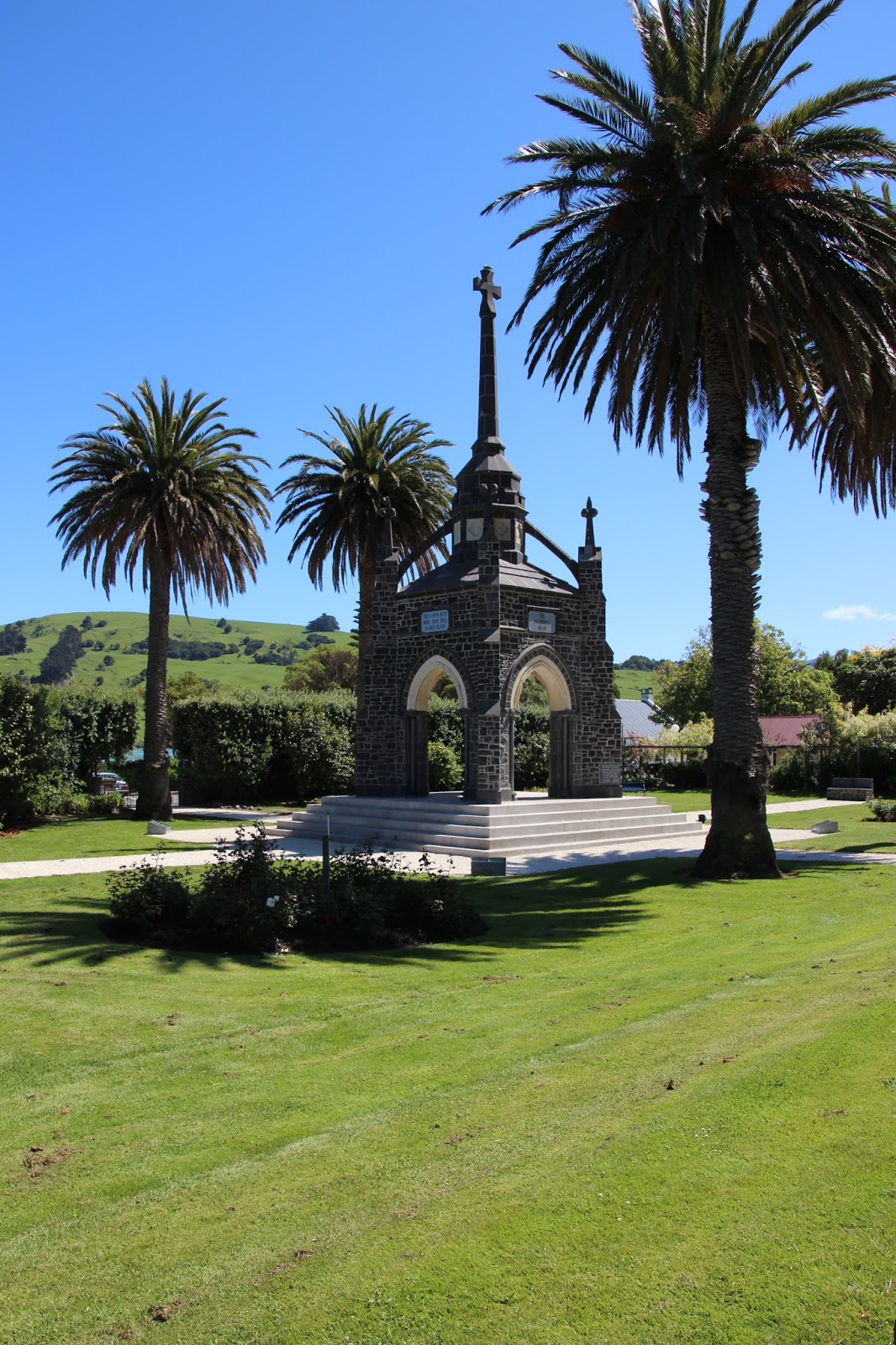
| War memorial in Akaroa |
We made our way to Monteith’s
pub and had some more beers and fun conversation. We were drinking with
Aussies, but we really weren’t scared! We found the shuttle pickup point and
made our way back to the ship.
 |
| Old Catholic church in Akaroa |
We didn’t do a lot in Wellington, but
considering the weather, we were happy with our time and can also say we’ve
been to New Zealand.
The next morning we found the ship
anchored offshore in Akaroa Harbour. Today we would be tendering into the town
of Akaroa to see the sights. Since none of the ship’s shore excursions excited
us enough to purchase them, we would be sightseeing on our own again. After a
leisurely breakfast, we gathered our things and proceeded to the tender deck
for our boarding and 15-minute ride to the docks.
 |
| Akaroa lighthouse and harbor |
We were pleased that the sun
was shining, the wind had died down, and the temperature was where it should be
for this time of year, as this looked like another of the 2 or 3 really great
weather days we had seen since we arrived in AUS/NZ.
 |
| Pretty flowers in Akaroa |
We rode the tender through
the placid, picturesque harbor and immediately got the feeling that this was
going to be one of those special places we sometimes come upon.
Akaroa sits on the Banks Peninsula,
named after the English naturalist Sir Joseph Banks after the first European
sighting by Captain Cook in 1770.
The Banks Peninsula was formed following
violent eruptions of 3 volcanoes (New Zealand is part of the Pacific Ring of
Fire which experiences considerable volcanic activity). Craters from these
volcanoes nurse the harbors of Akaroa and Lyttleton Harbours with smaller bays
indenting the rest of the coastline.
 |
| Dunedin railway station |
Originally inhabited by Maori natives, the
French captain, Jean Langlois of the whaling ship Cachalot, negotiated with the local Maori chief to buy Banks
Peninsula in 1838. Returning to France, Langlois organized a company of
emigrants to return to New Zealand and form a colony. However, by the time
Langlois and the emigrants returned in August, 1840, the Treaty of Waitangi had
been signed and New Zealand became an English colony. Because of these
developments, Akaroa still maintains a French heritage.
 |
| Coming into Dunedin |
After a very short walk along the
docks, we found ourselves in the heart of the Akaroa business district. Walking
along the harbor’s edge, we found numerous bistros and cafés, gift shops,
outfitter and adventure establishments, and hotels and restaurants all catering
to the tourist. Sheep farms sprinkle the hillsides surrounding Akaroa, and
industrial jobs can be found in Christchurch about a 1.5 hours’ drive away, but
tourism seems to be the anchor or Akaroa’s economy.
 |
| Old Dunedin prison |
We left the central area
and walked along the harbor’s edge until we came to a memorial we believe was
dedicated to those who died in war (there were no signs or plaques indicating
the structure’s purpose, just names engraved on the walls of the memorial).
Moving on we entered the traditional French area of the town replete with
French flags, signs, and various French businesses.
 |
| Getting that good spring water |
We found a postal
substation, so we bought some postcards and mailed them. We walked to the end
of town then made our way back through the central business district and on to
a lighthouse at the other end of town. Having seen about everything that had
been mentioned in the shore excursion guide, we returned to the dock and caught
the next tender back to the ship.
 |
| Copper fermenting vats |
Akaroa was a quaint, charming little village
and one we could envision returning to for an extended stay.
During the evening the ship was
repositioned to our last New Zealand port of Dunedin. Although the Otago
Peninsula, on which Dunedin is situated, had early European inhabitants from
whaling and sealing interests, it was the arrival of Presbyterian Scots
escaping religious persecution in 1848 that gave rise to the settlement.
 |
| Line 'em up. We're ready for a taste! |
Named
Dunedin, Scottish Gaelic for “Edinburgh on the hill,” the town was designed to
resemble the capital of Scotland. The discovery of gold in the surrounding
rivers and hills brought the town tremendous wealth that is reflected in the opulent
Victorian architecture found throughout the city.
Our ship passed through a
relatively narrow channel, lined on both sides with mud flats and wading birds,
to get to the terminal. Because Dunedin was so far from the terminal (we went
as far as we could go), we purchased a shore excursion to maximize our time in
the city.
 |
| In the Guiness Book of Records |
We boarded our bus and were whisked off to begin our tour. We were
taken to a park overlooking the city and harbor for a photo shoot, and then off
to Speight’s Brewery for a brewery tour. Speight’s is New Zealand’s largest
brewery, but very little of its production is exported (except to Hawaii and Fiji).
 |
| One steep baby! |
Deciding to expand operations, the canning and bottling operations were moved
to Christchurch with the intention of expanding exports. In 2011 an earthquake
hit Christchurch and destroyed all of the brewery’s infrastructure setting
these plans aback. However, recent wins in beer competitions in Colorado and
Germany has the company on track to expand exports.
 |
| In the botanic garden |
As a community service, Speight's shares the spring water the brewery sits upon with the public, and locals can be seen filling water bottles at a tap located outside the brewery walls. We viewed the equipment
used to brew the beers and then headed to the bar to sample their products. According
to Capt. Larry’s palate, all of the brews were quite excellent in their own category.
 |
| Cloudy sunset leaving Dunedin |
His recommendation is that if you happen to see Speight’s at your local beer
mart, give it a try. You probably won’t be disappointed.
 |
| Dunedin headland and lighthouse |
After the brewery
tour, our driver took us to Baldwin Street, “the steepest street in the world.”
And it was STEEP. So steep that it’s hard to imagine how anyone can navigate
it.
 |
| Entering Dusky Inlet |
We took some pictures while some crazy Chinese dudes started charging up
the hill to see how far they could get. It wasn’t far! Next we rode to the
Octagon, Dunedin’s central business district. With $100 NZ remaining in Kiwi
money and only 30 minutes before we moved on, Capt. Larry charged Jane with the
task of buying some souvenirs.
 |
| Dusky Sound |
Jane, not used to shopping hurriedly, almost
cracked under pressure!
 |
| Beautiful Dusky |
Down to her last $7 and spotting something that cost
$10, a vendor in an open air market took pity on her and made her a deal. Our
last point of interest was Dunedin Botanical Garden. Being spring everything
was blooming.
 |
| Entering Doubtful Sound |
 |
| Ready to view the sounds |
Our time was limited, but we snapped as many photos as we could.
We were returned to our ship and spent the rest of our afternoon relaxing.
We left Dunedin and traveled
through the night arriving at New Zealand’s famed Fiordland National Park.
Located on New Zealand’s southwestern tip, the park covers 3.1 million acres (nearly
5% of New Zealand’s land area), is a UNESCO World Heritage Area, and is home to
14 spectacular fiords along New Zealand’s rugged west coast.
 |
| Doubtful Sound |
Beginning 500
million years ago, intense heat and pressure deep in the Earth’s crust formed
gneiss, schist, and granite rock that was thrust upwards by folding of the
Earth’s crust. In the past two million years glaciers have periodically covered
the area gouging, deepening and rounding the U-shaped valleys that are now the
park’s fiords and lakes.
 |
| Another shot of Doubtful |
The park’s 14 fiords reach up to 25 miles inland and
extend along 125 miles of rugged coastline.
The park’s climate is typical of a
temperate rainforest with up to 300 inches of rain annually with flora and
fauna typical for such an environment.
 |
| Sheer granite peaks of Milford |
This heavy rainfall creates a unique
marine environment with a 130 foot layer of freshwater lying upon the sea water
within the fiords in which virtually all marine life is found. Originally, the
area was inhabited only by birds, plants, and trees.
|
| Breathtaking Milford Sound |
However, non-native
species introduced by European settlers upset the balance and 50% of native
species were wiped out.
Today we are very fortunate to
visit 3 of the sounds- Dusky, Doubtful, and Milford. Although they were
classified and named as sounds by Captain Cook and his crew in 1773, scientists
recognize they are truly fiords, but Cook’s categorization remains since that
was the name first laid down on nautical charts.
 |
| Milford Sound |
We entered Dusky Sound just
after 0800. The views were breathtaking.
 |
| Steep peaks and drizzle in Milford |
The sounds are all noted for an
abundance of wildlife, but we didn’t see any evidence of this in any of the
sounds; just the beauty of the towering peaks rising from the crystal blue
water and waterfalls tumbling back into the sea.
 |
| One of Milford's many waterfalls |
After making our way through
Dusky Sound, we returned to the fury of the Tasman Sea with 20-25 kt. winds and
10-12 foot seas. Around 1030 we tucked into the inlet of Doubtful Sound and
into sheltered, calm conditions. And spectacular scenery again. While
different, Doubtful was just as remarkable as Dusky.
 |
| Jane & Milford's Elephant Falls |
Doubtful is best known for
its black coral trees which occur in unusually shallow water for what is
normally a deep water species. We left Doubtful and sailed back into the Tasman
tempest, on our way to Milford Sound, the crown jewel of Fiordland. Arriving at
the Milford inlet around 1500, we were stunned by the raw, unspoiled beauty that looked like a sculpted work of art.
 |
| Tourist boat at a Milford waterfall |
Milford receives the largest
amount of rainfall and is adorned by an assortment of magnificent waterfalls.
We followed the fiord to Elephant Falls and the town of Milford, a small
community with a hotel and home base to a number of sound tours.
 |
| End of the road- the town of Milford |
We couldn’t
navigate the sound any further so we turned around and headed back to the
Tasman Sea where we set a WNW course for Melbourne, Australia. Our captain, Master
Juan “Hell-bent” Carangid, announced that a low pressure system would descend
upon us during the night and we would experience worsening conditions with
northerly winds to 50 kts. and 12-14 ft. seas. Somehow the weather forecast
didn’t seem to cause “Hell-bent” to slow down and we rock and rolled all
through the night while maintaining our course and 18-19 kt. speed for
Australia.


No comments:
Post a Comment